Who we are
The Environmental Physics group was founded in April 2010 and studies mainly atmospheric flows using automatically operating unmanned aircraft (UAV), measurement-station networks (rural valley and urban terrain), and numerical simulations (CFD). The group’s expertise lies in investigating turbulent exchange and transport processes in the atmospheric boundary layer (ABL), including momentum, heat, water vapour, CO2 and aerosol fluxes. Besides fundamental research, the group uses this expertise in various projects relating to wind-energy research, both off-shore and in complex terrain. The current generation of UAV (named MASC: Multi-Purpose Airborne Sensor Carrier) developed in Tübingen is designed for atmospheric boundary layer and wind-energy research, carrying fast turbulence sensors (up to 30 Hz) and a particle counter.
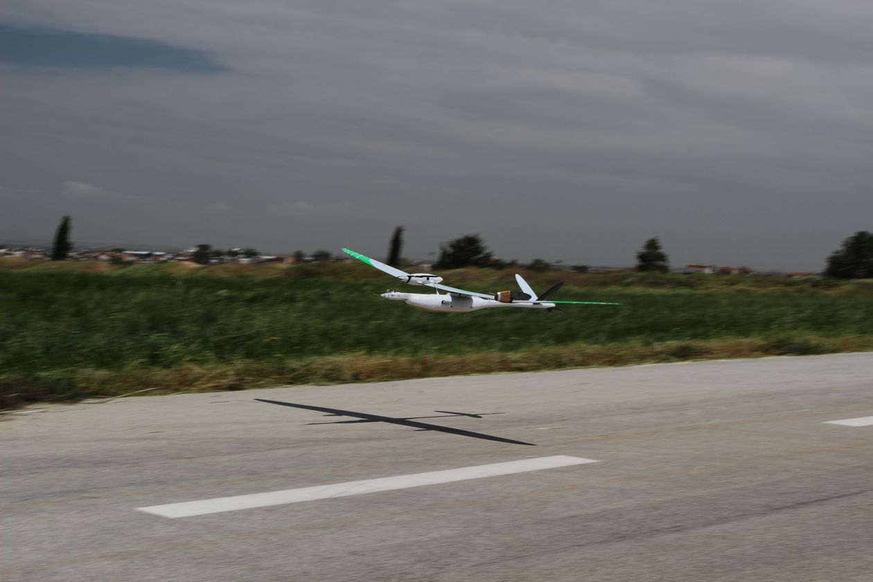
Wind energy in complex terrain
The project Lidar Complex was initiated by the research network WindForS. Its goals are the development of lidar technology in topographically complex terrain, improving the understanding of wind fields over these environments, and the influence of these wind fields on wind turbines. The follow up project WINSENT builds up on the findings of Lidar Complex and focuses on data before, during and after the installation of two scientific wind turbines.
Several campaigns were conducted in the Swabian Albs, and close to the Baltic Sea, using several comparative measurement systems. The MASC3, the latest iteration of the MASC UAS, is used to measure vertical profiles of temperature, humidity, wind, particles and electrostatic charges as well as turbulent structures up- and down-stream of a wind turbine.
Marine boundary-layer research
We conducted multiple campaigns with MASC and MASC-V to measure the maritime atmospheric boundary layer from the island of Helgoland. This unique island experiences the same weather as the many offshore wind energy installations in the region; so very strong winds! We measured the vertical structure of wind speeds (up to 80 kph), temperature, and turbulence, up to heights of 500 m above sea level, which is far higher than tower-based measurements are capable of. The MASC-V missions were carried out BVLOS in a distance of up to 12 km away from the island in just 30 m above the sea surface. The primary objective is to test models of the wind and turbulence profiles, and particularly how they are affected by very weak upwards and downwards transfers of heat, which can be a daily cycle controlled by the temperature of mainland Europe if the wind comes from that direction. The very weak heat exchanges cause a complete change in structure of the lower atmosphere, depending on whether the heat transfer is upward or downward. The atmosphere can be convective, so very homogeneous and turbulent, or stable, when there are steep gradients of the wind speed, and turbulence is suppressed. The transition between these regimes can occur during a change of surface air temperature of just one degree Celsius.
Ground Based CO2 Measurements
During the last years, the environmental-physics group at the University of Tübingen developed the suited type of low-cost sensors for this project. The usual disadvantage of low-cost equipment compared to high-grade sensors is a reduced absolute accuracy. Therefore, the sensor network will be complemented by an EC station that does not only deliver higher accuracy for the calibration of the network, but also the directly measured turbulent gas and heat fluxes, at least at one single location. The EC station is thus the reference for the calibration, for the determination of the turbulent exchange coefficients and for the long-term stability of the network.
In addition to the CO2 measurement, the low-cost sensors will also be equipped with air temperature and air humidity sensors. Within the project, all sensors have to be obtained, but not financed: the entire equipment for the proposed project is already funded by the Alfred-Teufel foundation. Finally, the measured data will be added to a data base and offered to the science community via an internet interface.

Numerical modelling for wind-energy research
By quantifying the influence of surface heterogeneity in the airflow, we can improve numerical simulations using measured data. In order to quantify the surface heterogeneities, airborne measurements were carried out in the inflow area. We made vertical profiles of the wind speed, direction, temperature, and humidity at various locations along a horizontal line perpendicular to the mean wind direction. A second flight strategy consisted of horizontal straight and level flights along the mean wind direction at two locations and at several altitudes. This provides a 3D dimensional picture of the inflow. This method was already successfully applied over the escarpment at the Swabian Alb.
Particle measurements
In the framework of a DFG project we study aerosols in the Earth’s atmosphere, using UAV-based measurements. At the moment our group uses two systems for that: MASC and a Multicopter. Aerosols are tiny particles typically between a few nanometers and several micrometers in size. Key aerosol constituents include sulfates, organic carbon, black carbon, nitrates, mineral dust, pollen, and sea salt. The media often uses everyday terms that hint at aerosol sources, such as smoke, ash, and soot. Aerosol can be found in the air over oceans, deserts, mountains, forests, ice, and every ecosystem in between. They drift in the Earth’s atmosphere from the stratosphere to the surface. Despite their small size, they have major impacts on our climate (e.g. sulfates, black carbon) and our health (e.g. pollen). As a secondary effect, aerosol can act as cloud condensation nuclei; without aerosol no clouds could form. Using our airborne systems, we are able to profile the atmosphere and measure these particles in-situ in order to understand the formation and distribution of aerosol and their impact on climate.