Remote Sensing for Measuring Housing Supply in Kigali (2017-2020)
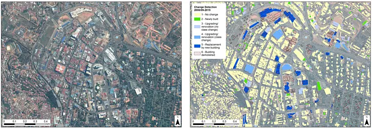
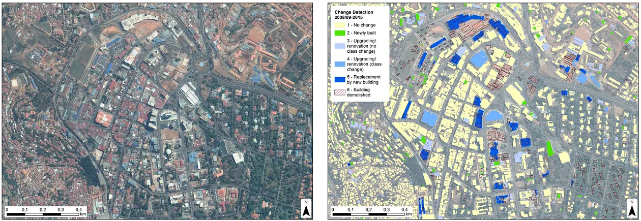
This project tests the ability of remote sensing to cost-effectively monitor and measure housing supply in data-poor cities, and demonstrates the usefulness and limitations of the resulting data for i) analyses of housing market and density trends, and ii) computerised mass land valuations. This project thus supports two core components of the IGC’s Rwanda (and international) cities agenda- affordable housing and land value taxation- as well as shedding light on questions of broader interest for understanding cities, such as the impact of factors like infrastructure and building regulations on density and land values, and the potential for new data and analysis techniques to improve our ability to understand and manage cities (including applications of machine learning to test the strength of more and less costly datasets to predict land values, extending analyses like that in Glaeser’s ‘Big Data and Big Cities’ to a developing country, data-poor, context).
Funding by the International Growth Centre (IGC), based at the London School of Economics (LSE)
