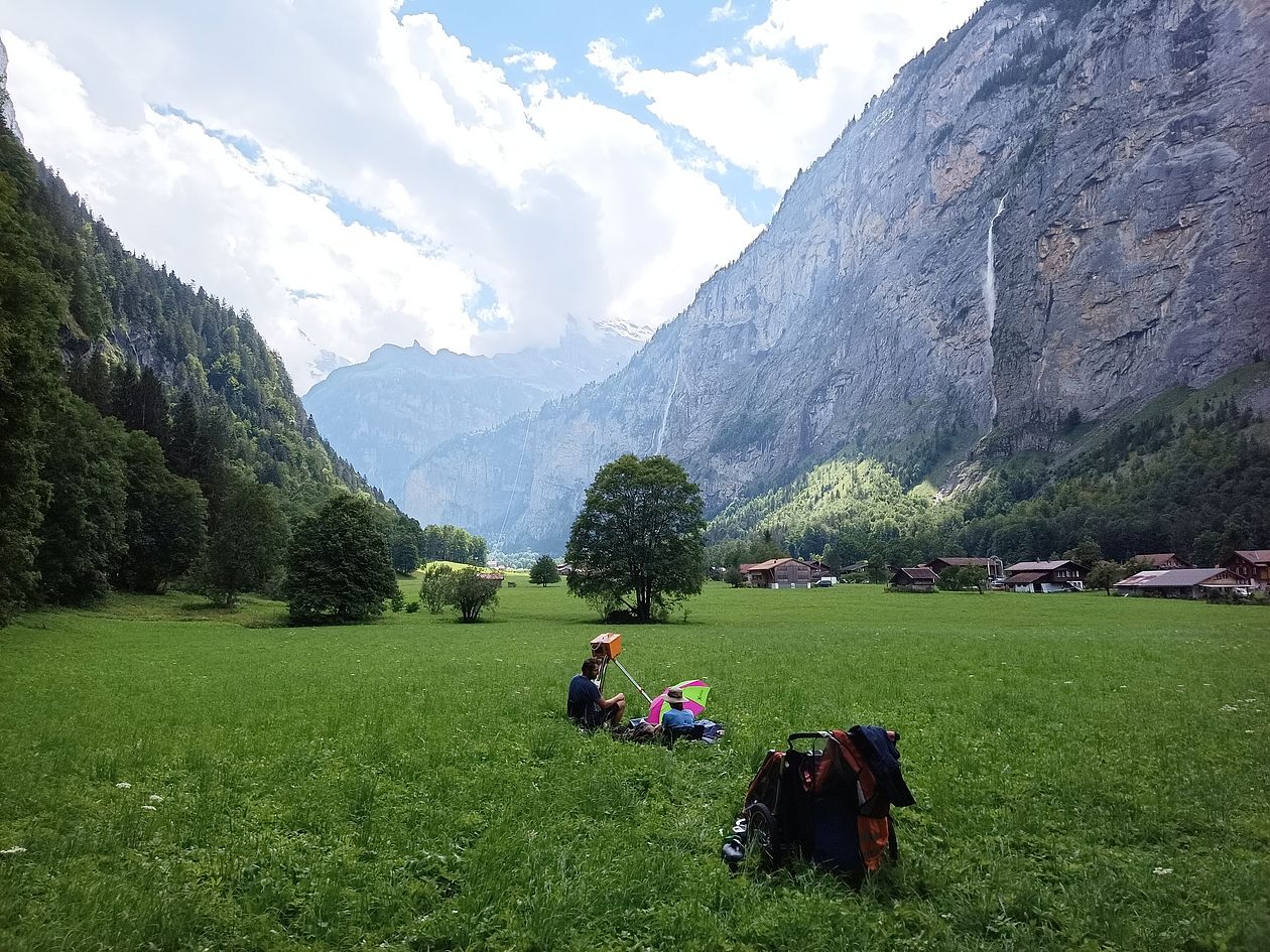
Our laboratory holds surveying equipment to measure highly resolved topographical data of natural (rock) surfaces in millimetre to centimetre spatial resolution and accuracy. This data is used to create digital elevation models (DEMs). Repeating surface measurements over time allows comparison of DEMs and detection of erosion and deposition during the time passed. Based on these spatio-temporal changes, we quantify and formalize surface process dynamics on hillslopes and in riverbeds.
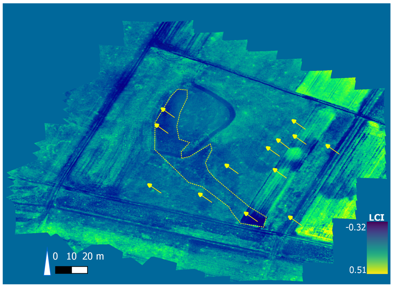
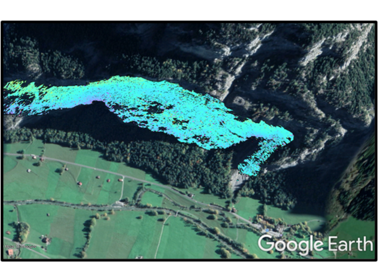
For long-range surveying we apply an OPTECH ILRIS LR terrestrial laser scanner that can survey over two-kilometre distance. This has been applied to detect rockfall and glacial flow. For mid-range surveying of 100-200 meters, we apply a FARO FOCUS 3D terrestrial laser scanner that can be used in narrow environments, like river channels. At this spatial range, we further use various unoccupied aerial vehicles (UAV, drones) like DJI Mavic P4M and 3T to assess connections between surface changes and vegetation based on DEMs built by photogrammetry methods. Local surface dynamics in (sub-)millimetre resolution, but larger extent is studied by a terrestrial radar interferometer (GAMMA GPRI II) and SLR-cameras (SONY ALPHA 7RII).
For further information contact Alexander Beer
