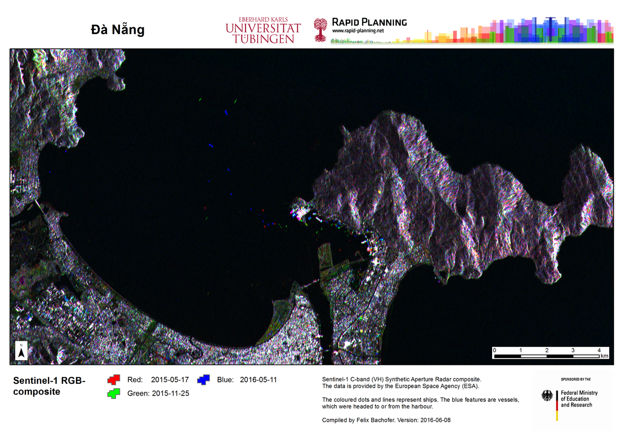
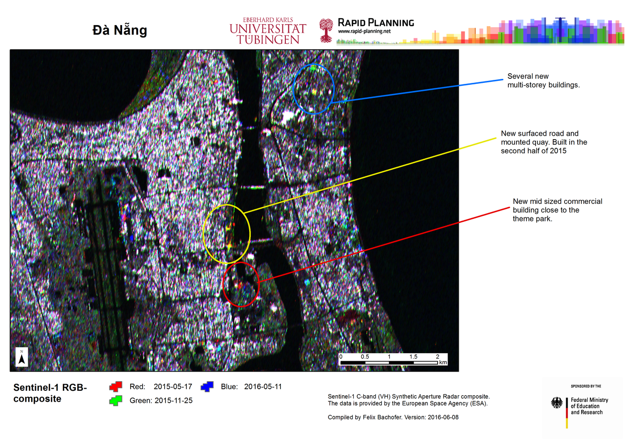
Change detection of DaNang with Sentinel-1 images
The backscatter signal of SAR (Synthetic Aperture Radar) sensors provide distinct information on land-cover than multispectral images. Sentinel-1 C-band (VH) Synthetic Aperture Radar composite of DaNang in Central Vietnam. Sentinel-1 is a satellite mission funded by the European Union and carried out by the European Space Agency within the Copernicus programme.
The figures show the city of DaNang (Vietnam) with a colour composite of three different scenes. The dates for data acquisition are 2015-05-17 / 2015-11-25 / 2016-05-11. Greyscale values (black to white) indicate the intensity of the SAR backscatter intensity. Colours represent variations of backscatter, which occurred in one or more of the three scenes. In most cases these changes are related to vegetational changes or to building activity.
The data is provided by the European Space Agency (ESA).
Contact information:
University of Tübingen
Faculty of Science
Geoinformatics Group
Rümelinstraße 19-23 (W402)
72070 Tübingen
Telefon +49 7071-29-77528
