1 General information
DFG reference no.: HA 644311-1
Project number: 389351859
Project title: Nomad state formation and urbanization: The early medieval town of Dzhankent (Aral Sea region, Kazakhstan) - Nomadenstaatbildung und Urbanisierung an der nördlichen Seidenstraße: Die frühmittelalterliche Stadt Dzhankent (Aral-See-Gebiet, Kasachstan)
Names of applicants: Prof. Dr. Heinrich Härke
Institut für Ur- und Frühgeschichte und Archäologie des Mittelalters
Eberhard Karls Universität Tübingen
Burgsteige 11, Schloss Hohentübingen
72070 Tübingen
Name of cooperation (local) partner: Dr. Azilkhan A. Tazhekeev
Korkyt-Ata Kyzylorda University, Kazakhstan
Reporting period (with extensions): 10 November 2017 – 31 May 2023
2.1 Zusammenfassung
Dieses Projekt befasst sich mit den Faktoren, die im Frühmittelalter zur Entstehung von Städten in einer zuvor nicht urbanisierten Region Zentralasiens, führten. Während arabische Schriftquellen des 10. Jahrhunderts Dzhankent (türkisch für „Neue Stadt“) als Hauptstadt der Oguz (einer Föderation türkischer Nomadenstämme) erwähnen, belegen unsere neuen archäologischen Funde und C14-Daten aus der verlassenen Stadt am unteren Syr-darja einen viel früheren Ursprung der Siedlung, nämlich im 6. Jahrhundert – und damit genau zu der Zeit, als der Handel auf der nördlichen Seidenstraße durch diese Region einsetzte. Funden zufolge gab es dann sehr bald Kontakte zum südlicher gelegenen Handelszentrum Choresmien am Amu-darja. Ein faszinierender Fund aus dieser Phase ist das Skelett einer Katze aus dem späten 8. Jahrhundert, die erste in dieser Region ausgegrabene Hauskatze. Im späten 9. Jahrhundert, nach der Einwanderung der Oguz und wahrscheinlich unter ihrer Kontrolle, wurde die Siedlung als ummauerte Planstadt nach choresmischem Muster neu angelegt, allerdings ohne die monumentalen Gebäude, wie sie für Zentren von “Nomadenstaaten” dieser Zeit typisch waren. In dieser neuen Form existierte Dzhankent nicht viel länger als ein Jahrhundert, eine kurzlebige „boom town“ an der Kreuzung der nördlichen Seidenstraße und dem dokumentierten Nord-Süd-Handel zwischen Zentralasien und Nordeuropa. Naturwissenschaftliche Analysen von Proben aus einem eigenartigen Anbau an der nördlichen Stadtmauer legen nahe, dass dies einst ein Sklavenpferch war, was wiederum darauf schließen lässt, dass Dzhankent eine Rolle im florierenden Sklavenhandel dieser Zeit gespielt haben könnte – und dann aufgegeben wurde, als dieser Handel im späten 10. oder frühen 11. Jahrhundert versiegte. Es dürfte kein Zufall sein, dass der historisch dokumentierte Zerfall des „Nomadenstaats“ der Oguz genau in diese Zeit fiel. Umweltveränderungen könnten ein zusätzlicher Faktor gewesen sein, verlässliche Belege dafür gibt es jedoch nicht. Die Stadtgeschichte, wie sie sich aus den Ergebnissen unseres Projekts und aus dem historischen Kontext ergibt, verdeutlicht hier ein Zusammenspiel von Faktoren bei der Entstehung der Stadtwerdung: Geografie, Handel und Bevölkerungsstruktur.
2.2 Summary
This project has addressed the interaction of factors leading in the Early Middle Ages to the emergence of towns in a previously non-urbanized region of Central Asia. While Arabic written sources of the 10th century report Dzhankent (Turkic for ‘New Town’) on the lower Syr-darya as the capital of the Oguz (a federation of Turkic nomads), new archaeological evidence and C14 dates from the deserted town demonstrate a much earlier origin of the settlement: in the 6th century, very exactly the time when the Northern Silk Road started operating through this region. According to finds, there were soon contacts to the southern trading hub of Khwarazm on the Amu-darya. An intriguing find from this phase is the late 8th century skeleton of a domesticated cat, the first one known from this region. In the late 9th century, after the arrival of the Oguz and probably under their control, the settlement was rebuilt as a walled town on a Khwarazmian model, but without the monumental buildings one would expect in a ‘nomad capital’ of this period. In its new shape, Dzhankent existed for not much longer than a century, being a short-lived ‘boom town’ on the intersection of the Northern Silk road and the documented north-south trade corridor between Central Asia and northern Europe. Scientific analyses of samples from a curious annexe against the northern town wall suggest that this was at one time a slave pen, implying that Dzhankent may have played a role in the thriving slave trade of the period – and was then abandoned when that trade folded in the late 10th or early 11th century. It is hardly a coincidence that the historically documented ‘nomad state’ of the Oguz disintegrated at exactly that time. Environmental change may have been a contributing factor, but there is no solid evidence for that. The town’s history as it emerges from the results of our project and from the wider historical context highlights a n interplay of factors in the emergence of urbanism in this place: geography, trade, and population interactions.
3 Progress report
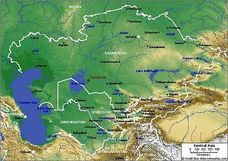
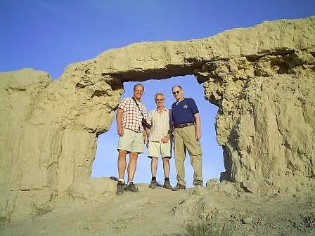
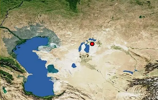
The project was intended to contribute to the debates on urbanization and state formation in early medieval Eurasia, focusing on a case study on the Northern Silk Road, in the contact zone of Turkic nomads and sedentary civilizations (Fig. 1). The planned methodology was based on the type of geoarchaeology as developed by our site director, Dr. I. Arzhantseva, on other Eurasian sites of the period (see Arzhantseva et al. 2011). Cooperation with local archaeologists was expected to strengthen regional archaeology which had been newly based at the University of Kyzylorda (Arzhantseva et al. 2012); to this end, we also wanted Kazakh research students to work for a Tübingen doctorate. Our application had also expressed some hope that the project might contribute to the further development of tourism in the region.
Our hypotheses from 2017 can be summarized as follows: a local settlement of the Dzhety-asar Culture was transformed in the late 9th to 10th centuries into a planned town, a development sparked by the Northern Silk Road on its doorstep. The probably multi-ethnic town was abandoned in the 11th or 12th century, either because of the disintegration of the Oguz nomad polity, or because of a shift of river channels of the Syr-darya. These hypotheses were in specific contradiction to the traditional, text-based model of Dzhankent being the 10th century ‘capital’ of a nomad ‘state’ (see Bajpakov et al. 2012), a model constructed in the absence of large-scale excavations at, and without radiocarbon dates from, Dzhankent.
The key results from our project now suggest the following picture. Settlement at this location had its origin in a 6th century enclosed ‘manor’ of the regional Dzhety-asar Culture. Finds from our excavations support the older idea of a multi-ethnic population. After re-planning, parts of the developing town had a regular chequerboard pattern by the 10th century, but while there are signs of wealth in some excavated buildings, there is no clear evidence that this was the capital of a state-like polity. The apparent wealth of the town in its late phase was probably based on its ‘cross-roads’ location, at the junction of east-west and north-south trade corridors. This trade seems, on archaeological-scientific evidence and geographical arguments, to have included the historically documented slave trade from the north to Central Asia. The end of this trade in the 11th century provides, in turn, a compelling explanation for the end of Dzhankent (while other factors may have contributed). Thus, none of the original hypotheses has been falsified although one had to be extended to include a third factor (the end of trade).
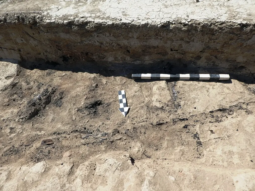
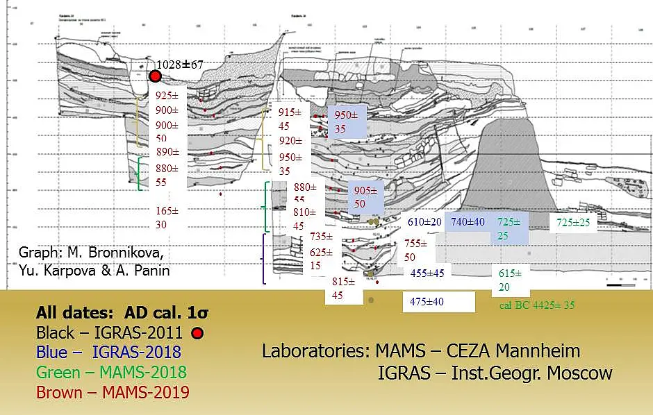
The new dates for the urban history of Dzhankent are based on a large series of radiocarbon dates (Fig. 2). Samples for these were taken by the soil scientist (Dr. M. Bronnikova) and the geomorphologist (Prof. A. Panin) of our team, and processed and dated at CEZA Mannheim (with a small series of dates from Moscow). These are not just the first radiocarbon dates for Dzhankent itself and the Lower Syr-darya region, but also the first stratigraphically fixed series of C14 dates for the Early Middle Ages in Central Asia – which makes them the reference series for years to come (conference report Bronnikova et al. 2020).
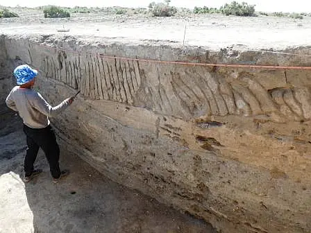
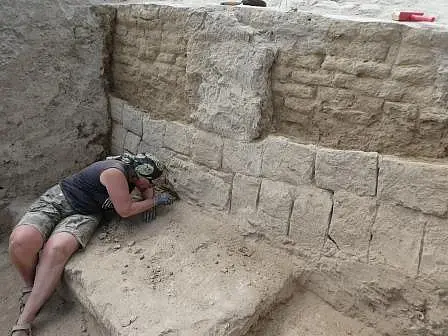
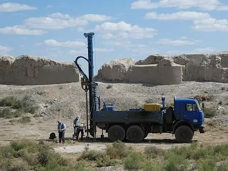
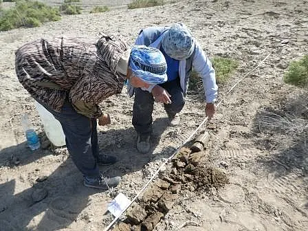
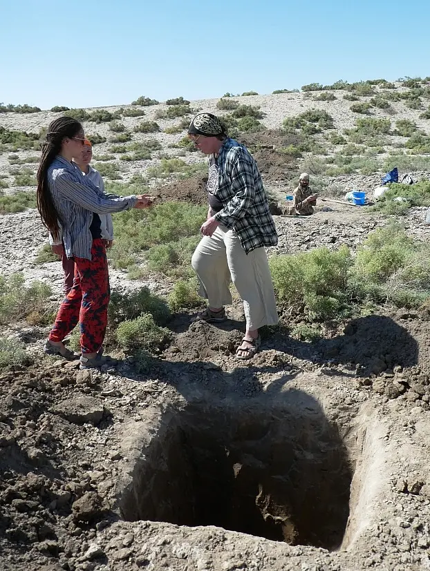
The extent and the depth of the cultural layers of the town was probed and documented by coring (supervised and interpreted by Dr. Bronnikova and Prof. Panin). In the first fieldwork year (2018), this was done by manual coring, in 2019 by mechanical coring (with lorry-mounted apparatus coring down to natural, mostly around 8 m below modern surface). Mechanical coring was done on a systematic grid, providing information on, and dates for, occupation across the interior of the enclosed town area (Bronnikova et al. 2020). This was a deviation from the original plan, replacing time-consuming conventional trenches with much less invasive, rapid cores.
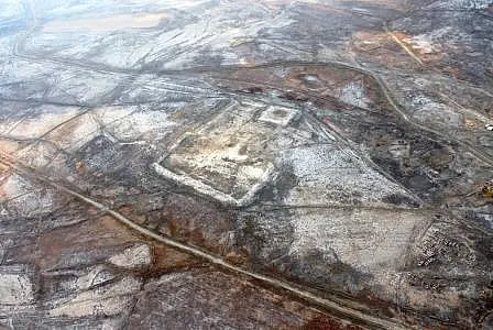
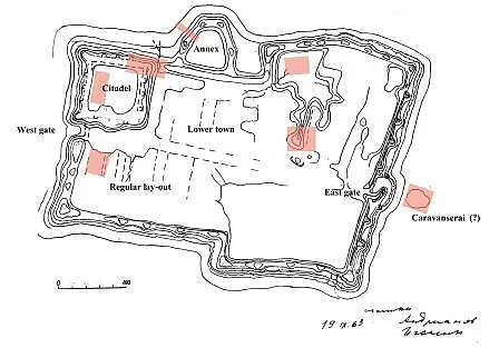
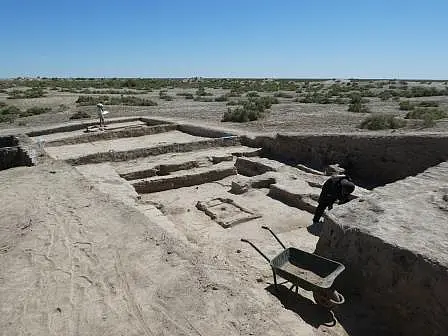
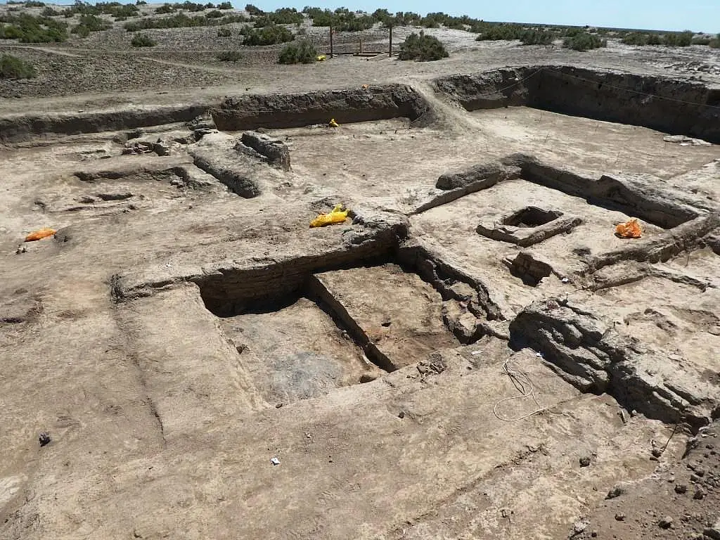
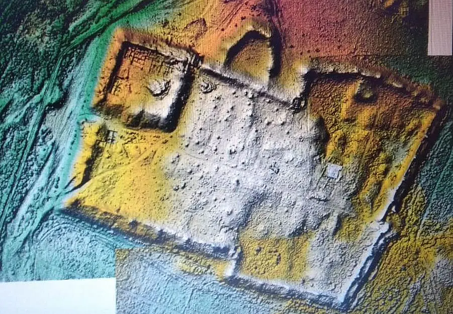
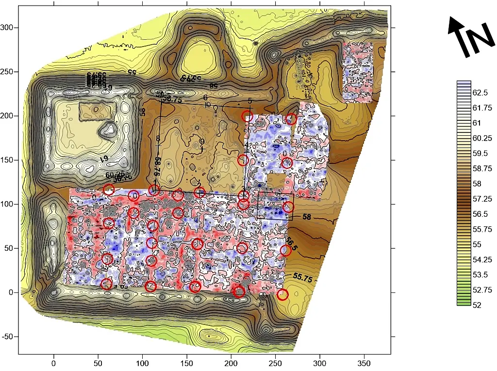
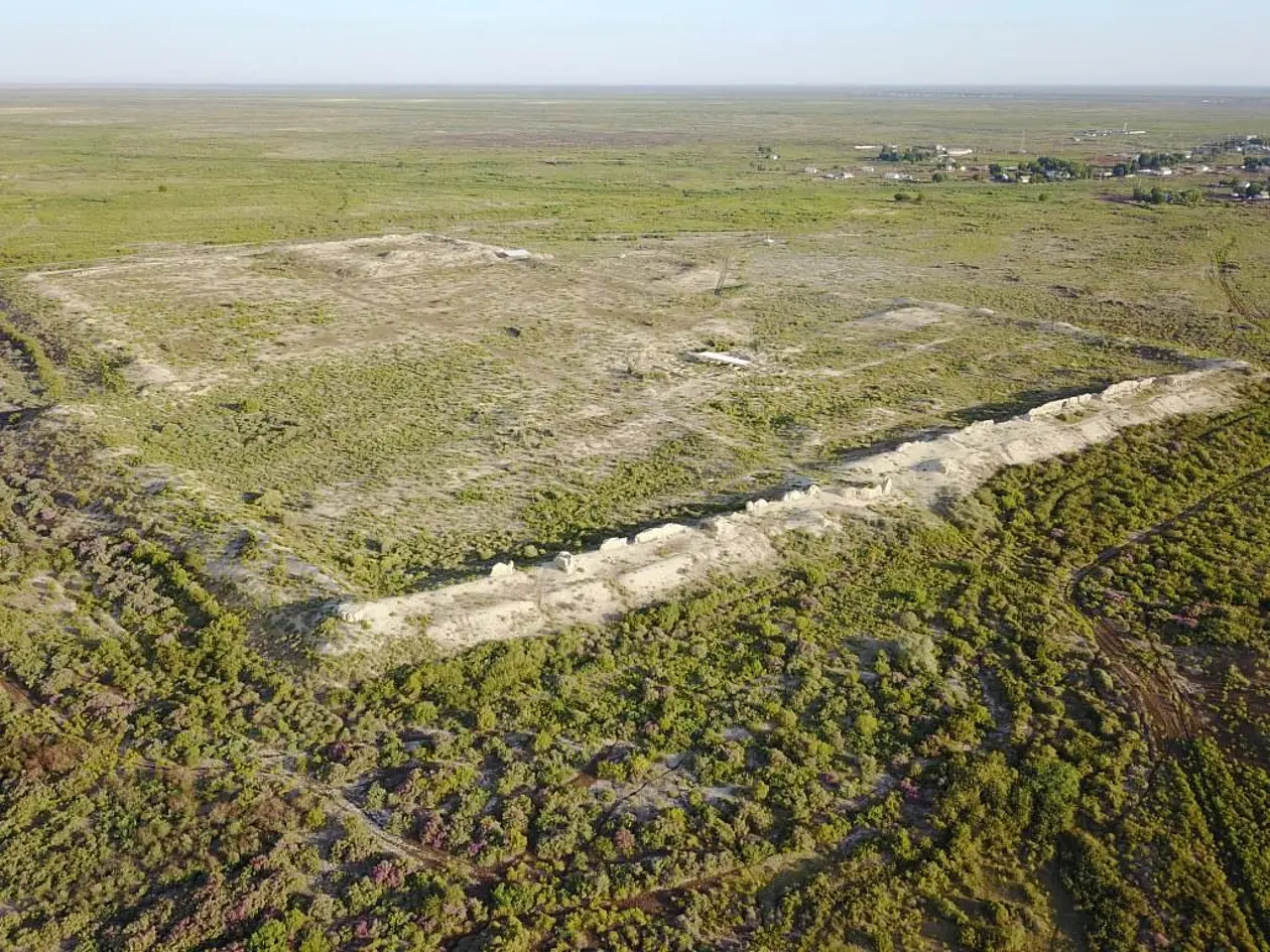
In parallel, the entire urban area (16 ha) was probed and mapped in 2018-2019 by our geophysics team (Prof. I. Modin), using magnetometry, electrical resistivity, electrotomography and drone photography. Outcomes are an enhanced-relief 3D model of the town in its current shape, showing surface details not seen before on aerial photographs nor in topographic maps (Fig. 3); a plan of magnetic anomalies showing the complete lay-out of the final urban phase (10th century; Fig. 4); and a non-destructive section of the citadel which is a key element for the interpretation of the site.
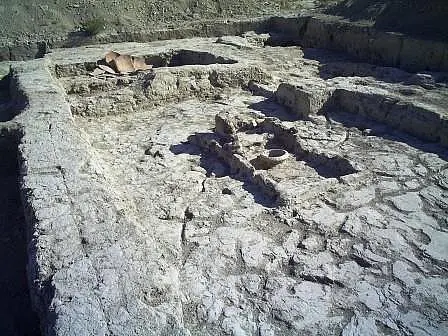
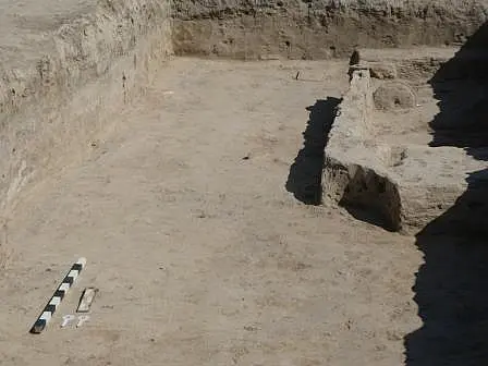
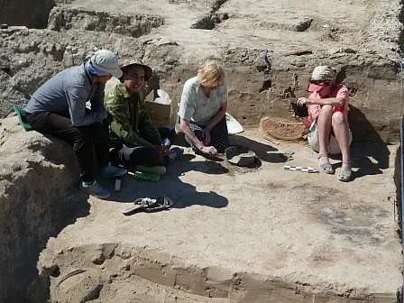
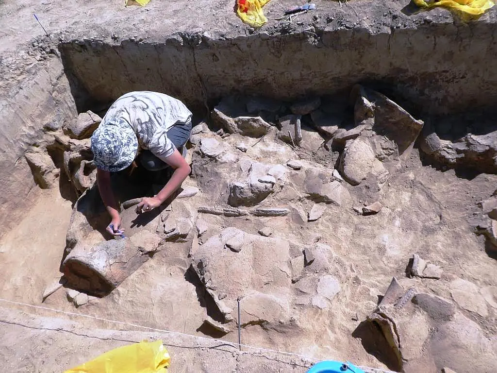
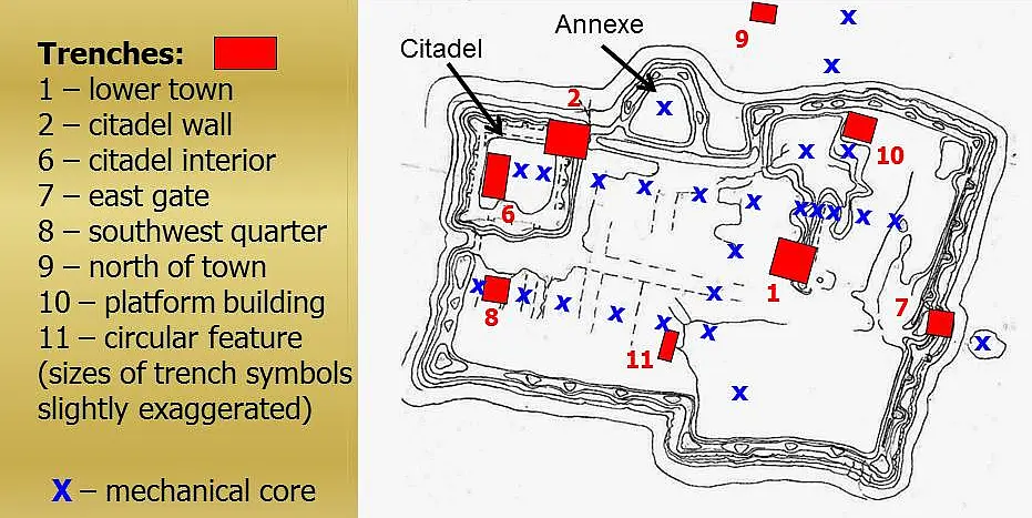
Conventional trenches were opened in the corner citadel (Nr. 6, site director Dr. I. Arzhantseva), in the lower town (shahristan: Nr. 8, supervisor Zh. Sultanzhanov M.A., and Nr. 11, D. Golikov B.A.), on the platform inside the northern wall (Nr. 10, Dr. A. Tazhekeev), at the eastern town gate (Nr. 7, S. Bilalov M.A.), and outside the northern town wall (Nr. 9, A. Tazhekeev; Fig. 5). Existing trenches were continued and extended on the junction of citadel and town walls (Nr. 2, S. Bilalov), and in the lower town (Nr. 1, A. Tazhekeev). The latter two trenches were important for stratigraphic control down to natural, and were used for complete radiocarbon series. In the lower town, the trenches provided insights into urban lay-out and house construction, mostly based on the ‘classic’ Khwarazmian type known from the Amu-darya region (Dr.phil. thesis Zh. Sultanzhanov at Tübingen). The lower town produced a couple of simple wall-paintings in Trench 1, but the monumental buildings which would be expected in the citadel of a regional or nomad ‘capital’ were found neither by geophysical methods nor in our new Trench 6; an older citadel trench by Almaty archaeologists (Trench 3; Bajpakov et al. 2012) had also failed in this respect. Outside the town walls, none of the expected buildings were found, neither to the north (Trench 9 where geophysics showed up anomalies from a suspected ‘crafts quarter’) nor to the east (coring in the suspected ‘caravanserai’ mound). The unusual overlap construction of the East gate (Trench 7) turned out to be an isolated 13th century refortification of the Mongol period when a Golden Horde town was built close by (Härke et al. 2019; Bilalov and Tazhekeev 2020).
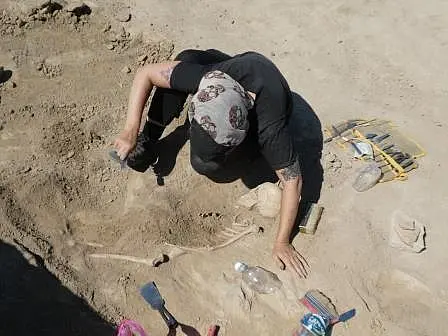
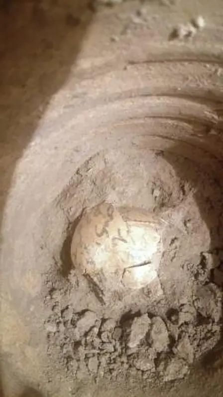
Finds from the trenches included a small number of 10th century coins (stamped Bukhara); large quantities of several distinct types of pottery (Dr.phil. thesis G. Amirgalina M.A. at Tübingen; Amirgalina 2019; 2020; Amirgalina et al. 2021); sherds from glass vessels some of which appear to be of Near Eastern origin (analysis by Dr. J. Henderson at Nottingham, report awaited); and large quantities of animal bones (analysis by Dr. A. Haruda, and for stable isotopes by Dr. A. Miller, reports awaited). The latter included the almost complete skeleton of a domestic cat, dated to the 8th century, which enjoyed quite a lot of attention in the media when published (Haruda et al. 2020). Another unusual find were three chicken eggs with Arabic lettering, found in a 10th century pot outside the northern citadel wall (restoration in Kunstkamera, St. Petersburg, report awaited).
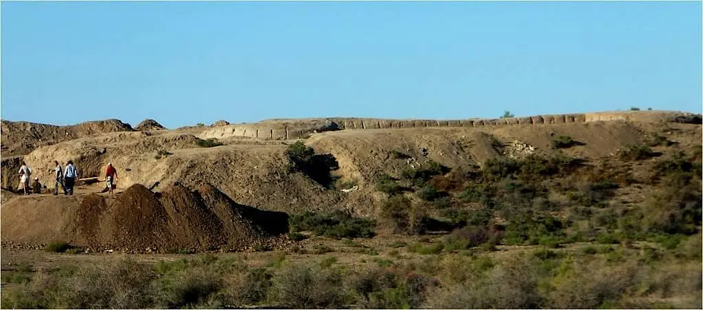
One of the most intriguing features of the site is the Annexe on the outside of the northern town wall (Fig. 4). It has an interior size of ca. 60 x 60 m enclosed by a wall slightly lower than the town wall. Geophysical prospection showed an absence of constructions in its interior, but subsequent coring revealed a cultural layer of 120 cm thickness. Mycological analysis of this layer revealed keratin-eating micro-fungi in the soil, indicating the presence of animals or humans (Dr. A. Ivanova); chemical analysis showed a significant presence of phosphorus, but not high enough for livestock, so probably from humans (Dr. M. Bronnikova). We could not get an aDNA specialist interested in this question, so contact was established to specialists for parasite and biomarker analysis, and sets of samples were taken in 2022 from a systematic series of test pits in the Annexe. The first run of parasite analysis produced no results (Dr. A. Smith, Oxford; second run to follow). The biomarker results (from Dr. Y. Wang, Jena; written report received) show use varying over time: from predominantly animals, to predominantly humans, to mixed use, all within the 9th – 10th centuries (according to C14 dates). The most likely interpretation therefore is that this was a slave compound, with intermittent use for animals. Slave and livestock trade from the north via the Volga south to Khwarazm is documented in 10th century written sources (e.g. al-Muqadassi), and implied by the huge numbers in Scandinavia of silver coins (dirhams) from the Islamic world. While the general assumption has been that the north-south trade route followed Ibn Fadlan’s early 10th century track across Ust-Yurt, there are good reasons to suggest that slave caravans and livestock herds may have avoided the hostile environment of Ust-Yurt by circling east around the Aral Sea – which would give Dzhankent a strategic location as a transshipping port at the interface of overland route, river Syr-Darya, and Aral Sea (Härke and Arzhantseva 2021).
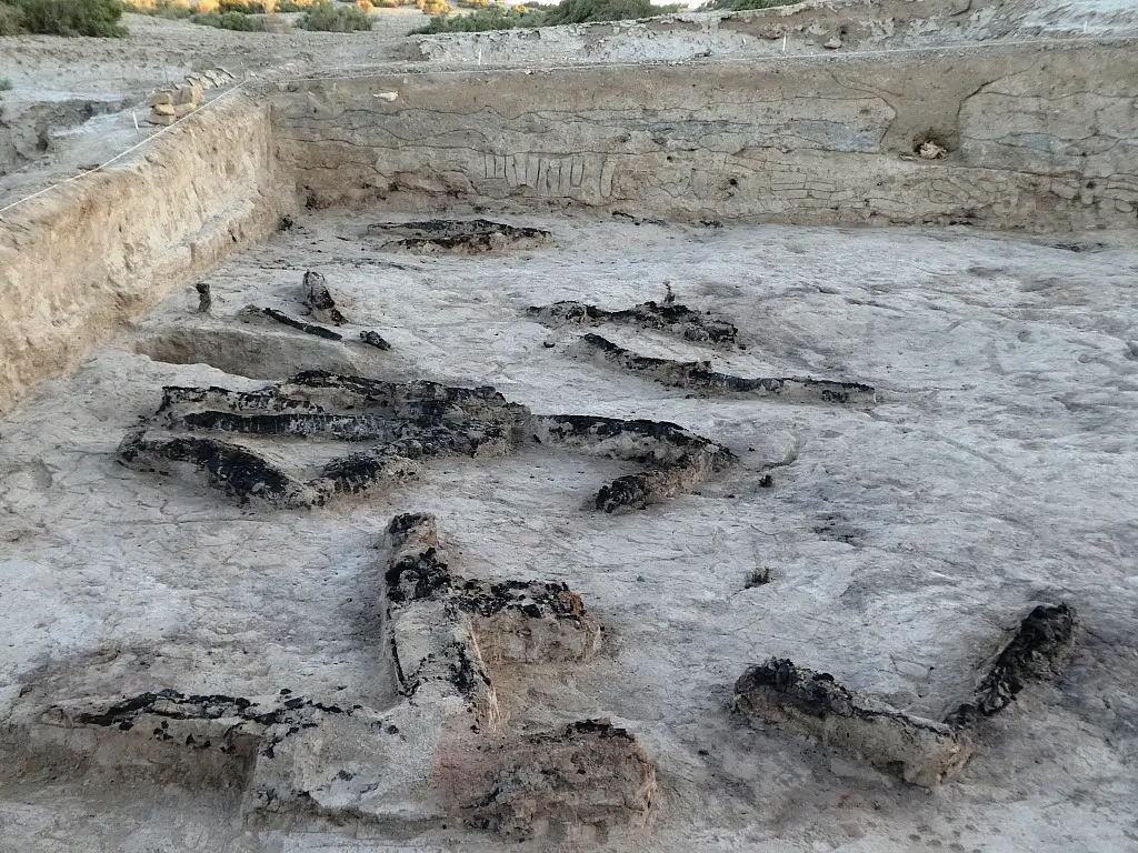
Our full set of radiocarbon dates (Fig. 2) highlights the fact that the urban phase of Dzhankent, from reconfiguration to abandonment, is just over a century which is remarkably short for a Central Asian town; and coincides closely with the so-called ‘silver flow’ of Islamic coins to Northern Europe, marking it out as a ‘boom town’ which failed when the main reason for its existence disappeared. This does not exclude other factors adding to this decline: electrotomography and stratigraphy of the citadel have shown up traces of a major conflagration in the top layers, and there was a smaller fire at that time in the area of Trench 1 (Bronnikova et al. 2020). This may well be a reflection of the break-up of the Oguz polity at exactly this time – which may, in turn, have been sparked by the decline in the northern trade, and the end of a controlling position of the Oguz yabgu (khan) in the slave trade. The results of our project at Dzhankent, thus, have the potential of contributing to historical interpretations of much wider significance.
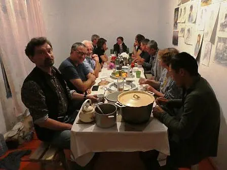
The switch to coring methodology mentioned above was discussed with the International Advisory Committee (IAC) whose members played an important role in overseeing, and advising on, approaches and methods. The key event in this element of quality control was our workshop in 2018 when the IAC met the project team for two days on site to inspect and discuss methods applied within the project. Another element was regular papers by team members at conferences in Central Asia because these presentations subjected our work to scrutiny and comment by expert audiences (see published presentations under 4.2). Full publication of the Dzhankent project 2017-2024 is assured and in preparation for a series of the Margulan Institute of Archaeology, Kazakh Ministry of Science and Education (Almaty). Further publications in refereed journals are envisaged, particularly with respect to applications of scientific methodology (geoarchaeology, glass analyses, biomarkers and parasites etc.).
Finds made during our fieldwork are kept in the stores of Kyzylorda University. They are accessible there, and have already been used by external colleagues; wider and less formal access will be possible after publication. The human bones from the modern burials inside Dzhankent have been reburied, as required by Muslim religious protocol, in the local cemetery of the village of Urkendeu.
The expected positive effect of our project on regional archaeology has materialized much as we had hoped for. Kyzylorda University (earlier KGU, now KAKU) has put its teaching of archaeology now on a regular basis, undergraduates have had their practicals at Dzhankent (in some years meeting, and mixing with, student participants from abroad) which, in turn, has inspired some of them to take postgraduate courses at other Kazakh universities. KAKU itself is now considering setting up its own Master’s course in Archaeology, which would consolidate the funding and staffing of their Research Center for Archaeology and Ethnology (itself the direct result of our first Dzhankent project in 2011 funded by the Wenner-Gren Foundation). Our DFG-funded project has also had the effect of making Kyzylorda archaeology more visible nationally: our local partner, Dr. Azilkhan Tazhekeev, who was the first director of the KAKU Research Center, has just left Kyzylorda for the directorship of the Astana branch of the Kazakh national Institute of Archaeology, being replaced at KAKU by another member of our team, Dr.des. Sejdaly Bilalov. And an Uzbek colleague, Dr. Ajsulu Iskanderova, has, attracted by our reports, started last year (2023) her own project at Dzhankent with external funding. Finally, two employees of the Kyzylorda Research Center (G. Amirgalina and Zh. Sultanzhanov) have had their doctoral research on Dzhankent topics funded by our project.
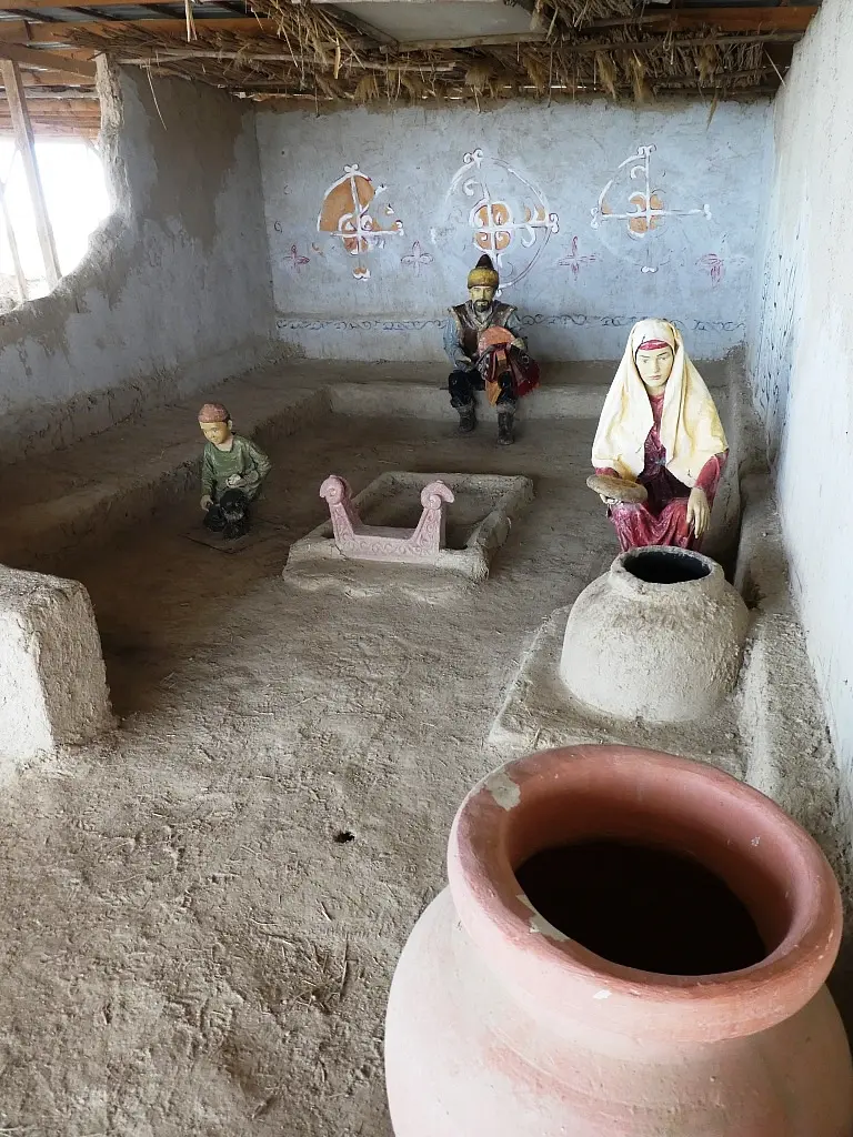
A hoped-for, non-scientific outcome of our project had been a positive effect on local tourism. While we cannot gauge the real impact on visitor numbers, the local administration (after pointed criticism from our German PI at a press conference 2019 in the regional capital of Kyzylorda) has built a tarmac road from the village to the site (ca. 2 km), has fenced in the site (against off-road biking and driving), put up a monument and new information board at the entrance, and provided a public toilet. Kazakh members of our team have obtained separate funding to improve visitor access to the citadel, have put up historical-archaeological information boards, roofed over Trenches1 and 2, and built the reconstruction of a small house in the lower town, showing interior lay-out and the location of typical features and artefacts (at Trench 1).
Relevant publications for Section 3 (in addition to project publications, below)
Arzhantseva, I., O. Inevatkina, V. Zav’yalov, H. Härke, A. Panin, I. Modin and S. Ruzanova 2011. Por-Bajin: An Enigmatic Site of the Uighurs in Southern Siberia. The European Archaeologist 35. 6-11.
Arzhantseva, I.A., H. Härke, M.S. Karamanova, S.A. Ruzanova, A.A. Tazhekeev and I.N. Modin Early medieval urbanization and state formation east of the Aral Sea: Fieldwork and international workshop 2011 in Kazakhstan. The European Archaeologist 3. 14-20. https://www.e-a-a.org/EAA/Publications/TEA/Archive/EAA/Navigation_Publications/TEA_content/Archive.aspx#37
Arzhantseva, I.A. and A.A. Tazhekeev 2017. Contested landscapes of Soviet Central Asia: an ethnoarchaeological case study from Kazakhstan. Journal of Conflict Archaeology 12:3. 177-191. DOI: 10.1080/15740773.2017.1480449
Baipakov K.M., Voyakin D.A., Ilin R.V. 2012. The towns of Huwara and Yangikent, the old and new capitals of the Oghuz state. Bulletin of IICAS 16. 22-44.
4.1 Published project results: Refereed publications
Amirgalina, G.T., L.A. Makhambetova and S.U. Bilalov 2021. ОРТАҒАСЫРЛЫҚ ЖАНКЕНТ ҚАЛАСЫНАН ТАБЫЛҒАН АСҮЙЛІК ЫДЫСТАРДЫҢ ЖІКТЕЛУІ. Al-Farabi Kazakh National University Bulletin of History 102. 120-129.
Arzhantseva, I. and S. Gorshenina 2018. The patrimonial project of Dzhankent: constructing a national symbol in the longue durée. Ancient Civilizations from Scythia to Siberia 24. 467-532.
Arzhantseva, I. and H. Härke 2019. “The General and his Army”: Metropolitans and Locals on the Khorezmian Expedition. In: S. Gorshenina, P. Bornet, M.E. Fuchs and C. Rapin (eds.). “Masters” and “Natives”: Digging the Others’ Past. Berlin and Boston: De Gruyter. 137-176.
Arzhantseva, I.A and H. Härke 2024. There used to be water: Soviet water policies, archaeologists, and ethnographers in Central Asia. In: J. Féaux de la Croix and B. Penati (eds.). Environmental Humanities in Central Asia. London and New York: Routledge, 31-54. DOI: 10.4324/9781003362364-3.
Bilalov, S. and A. Tazhekeyev 2020. Archaeological research on the main entrance gate of the medieval settlement Dzhankent 2019. Al-Farabi Kazakh National University Journal of History 96. 155-171.
Bronnikova, M.A., Karpova, J.O., Murasheva, V.V., Kochkina, A.F., Stashenkov, D.A., Arzhantseva, I.A., Härke, H., 2022. Micromorphological features of medieval cultural layers formed in different environmental backgrounds. Boletín de la Sociedad Geológica Mexicana 74 (3), A080822. DOI 10.18268/BSGM2022v74n3a080822. (Open access).
Féaux de la Croix, J., I. Arzhantseva, J. Dağyeli, E.-M. Dubuisson, H. Härke, B. Penati, A. Ueda and A. Wooden 2022. Roundtable Studying the Anthropocene in Central Asia. Central Asian Survey 41 No. 1. 180-203. DOI: 10.1080/02634937.2021.1960797 (Open access).
Härke, H., S. Bilalov and G. Amirgalina 2019. Preliminary results of archaeological research in the western gate of the medieval settlement Dzhankent in 2018. Vestnik (Seriya Istoricheskaya) Kazakhskij Natsionalnyj Universitet im. Al’-Farabi 93: 2. 31-40.
Härke, H., I.A. Arzhantseva and A. Tazhekeev 2020. The early medieval town of Dzhankent (Kazakhstan): from initial hypothesis to new model. The European Archaeologist 66. 27-34. www.e-a-a.org/EAA/Publications/Tea/Tea_66/Research_news/EAA/Navigation_Publications/Tea_66_content/
Härke, H. 2022. A Dozen Years of Central Asia: an archaeologist’s blog. Kulturní studia 18:1. 57-80. DOI: https://doi.org/10.7160/KS.2022.180103 (Open Access).
Härke, H. and I. Arzhantseva 2021. Interfaces and Crossroads, Contexts and Communications: Early Medieval Towns in the Syr-Darya Delta (Kazakhstan). Journal of Urban Archaeology 3. 51-63. https://doi.org/10.1484/J.JUA.5.123675 (Open Access).
Haruda, A.F., Ventresca Miller, A.R., Paijmans, J.L.A., Barlow, A., Tazhekeyev, A., Bilalov, S., Hesse, Y., Preick, M., King, T., Thomas, R., Härke, H. and Arzhantseva, I. 2020. The earliest domestic cat on the Silk Road. Scientific Reports 10:11241.DOI https://doi.org/10.1038/s41598-020-67798-6
Shoraev, B.K. and Zh.K. Sultanzhanov 2020. A review of written sources about Oghuz cities in Kazakhstan’s section of the Great Silk Road. Al-Farabi KNU Bulletin of History 2020. 34-42.
Tazhekeev, A. and Zh. Sultanzhanov 2022. On archaeological exploration work carried out in the vicinity of the medieval settlement Zhankent in 2019 and 2022. Kazakhstan Arkheologiyasy 17: 3. 91-102.
4.2. Other project publications: Conference papers (in chronological order)
Arzhantseva, I.A., H. Härke and A.A. Tazhekeev 2019. Geoarchaeology at Dzhankent: Urbanization and state formation on the Northern Silk Road. In: G.M. Mutanov (ed.). Proceedings of the international conference “Methods and methodology of archaeological sciences in archaeological field research”, 18 September 2019, Al-Farabi National Kazakh University. Almaty: Kazakh Universiteti. 4-11.
Arzhantseva, I., Härke, H. and Tazhekeev, A. A. 2019. Project "Nomad state formation and urbanization: The early medieval town of Dzhankent (Aral Sea region, Kazakhstan)". In: Antiquities of East Europe, South Asia and South Siberia in the Context of Connections and Interactions within the Eurasian Cultural Space (new data and concepts). Vol. 1. St. Petersburg : IIMK RAN. 239-241.
Bilalov, S. 2019. Zhankent in the works of the Russian Empire researchers. In: I. Yilmazcelik and F. Demirel (eds.), Proceedings of the International Symposium on Political, Economic and Cultural Development of the Turkic World from the Beginning of the 20th Century to the Present Day, 24-27 April 2018, Almaty, Kazakhstan. Ankara: Atatürk Arastirma Merkezi. 290-313.
Tazhekeev, A.A., I.A. Arzhantseva, G. Harke, S.U. Bilalov and G.T. Amirgalina 2019. Nekotoryye itogi i perspektivy izucheniya gorodishcha Dzhankent. In: Velikaya step': istoriya i kul'tura. Tom 3. Mir drevnikh tyurkov (exhibition catalogue). Nur-Sultan.
Amirgalina G.T. 2019. Keramika so znakami s gorodishch Dzhankent i Sortobe. In: Margulanovskiye chteniya – 2019: Materialy mezhdunarodnoy arkheologicheskoy nauchno-prakticheskoy konferentsii, posvyashchayetsya 95-letiyu so dnya rozhdeniya vydayushchegosya kazakhstanskogo arkheologa K.A. Akisheva. Nur-Sultan. 418-428.
Amirgalina G.T. 2020. Arkheologicheskiye nakhodki s gorodishcha Dzhankent za polevoy sezon 2019 goda. In: Margulanovskiye chteniya – 2020: materialy mezhdunarodnoy nauchno-prakticheskoy konferentsii «Velikaya Step' v svete arkheologicheskikh i mezhdistsiplinarnykh issledovaniy» (g. Almaty, 17–18 sentyabrya 2020 g.). Almaty: Institut arkheologii im. A.KH. Margulana. Vol. 2. 422-433.
Arzhantseva, I.A. 2020. The initial phase of the work of the Khorezm archaeological and ethnographic expedition in Kazakhstan (archives 1946–1951). In: B. A. Baitanayev (ed.), Margulan Readings – 2020: Proceedings of the International scientific and practical conference “Great Steppe in light of archaeological and interdisciplinary research” (Almaty, September 17–18, 2020). Vol. 1. Almaty: A.Kh. Margulan Institute of Archaeology (ISBN 978-601-7106-43-0). 67-80.
Härke, H., I.A. Arzhantseva, A.A. Tazhekeev, M. Bronnikova, I.N. Modin and A.V. Panin 2020. Interdisciplinary fieldwork at Jankent: Exploring early medieval urbanization on the Lower Syrdaya. In: B. A. Baitanayev (ed.), Margulan Readings – 2020 [as for Arzhantseva 2020, above]. 219-229.
Bronnikova, M.A., A.V. Panin, I.A. Arzhantseva, H. Harke and Yu.O. Karpova 2020. Радиоуглеродное датирование и пожарная история раннесредневекового города Джанкент (Ю-В Приаралье, Казахстан). In: Радиоуглерод в археологии и палеоэкологии. Под редакцией Н.Д. Буровой, А.А. Выборнова, М.А. Кульковой – СПб: ИИМК РАН, РГПУ, Самара: СГСПУ/ООО ≪Порто-принт≫, 17-18. DOI:10.31600/978-5-91867-213-6-17-18
Билалов С.Ө., Тәжекеев А.А., Дарменов Р.Т., Султанжанов Ж.К., Амиргалина Г.Т., Курманиязов И.С., Назаров А.Ж. 2021. 2020 ж. далалық маусымында ортағасырлық Жанкент қаласында жүргізілген археологиялық жұмыстар. In: Тарих ғылымдарының докторы, профессор Мадияр Елеуұлы Елеуовтың 75 жылдық мерейтойына арналған «Ұлы Жібек жолы мен Қазақстан керуен жолдарының урбанизация үдерісіндегі маңызы» атты халықаралық далалық семинар материалдары. Алматы. 158-169.
H. Haerke, I. Arzhantseva, A. Tazhekeev, M. Bronnikova, A. Panin and I. Modin 2022. On the interface of steppe and urban civilization: Interdisciplinary research at Dzhankent (6th – 11th centuries AD). In: A. Onggar et al. (eds.), Eurasian steppe civilization: human and historical and cultural environment. Proceedings of the 5th International Congress of Archaeology of the Eurasian Steppes (Turkistan, 11-14 October, 2022). Vol. 3. Almaty: Margulan Institute of Archaeology, 111-120. ISBN 978-601-7106-64-5.
