Geoinformatik / GIS

Rapid Planning (09/2014 to 08/2019)

Sustainable Infrastructure, Environmental and Resource Management for highly Dynamic Metropolises

Dynamically changing urban agglomerations in emerging countries in the Global South experience rapid changes in their urban structure, due to a growth of population and socioeconomic developments. For the monitoring of the housing sector, spatial and infrastructure planning, as well as supply of social services, frequent information on the qualitative and quantitative status of a settlement and its structure are necessary. The Geoinformatics Group of the University of Tübingen is part of the RapidPlanning research consortium, which adresses these topics „Rapid Planning - Sustainable Infrastructure, Environmental and Resource Management for highly Dynamic Metropolises“. The project is funded by the German Ministry of Education and Research for five years.


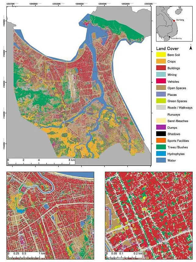
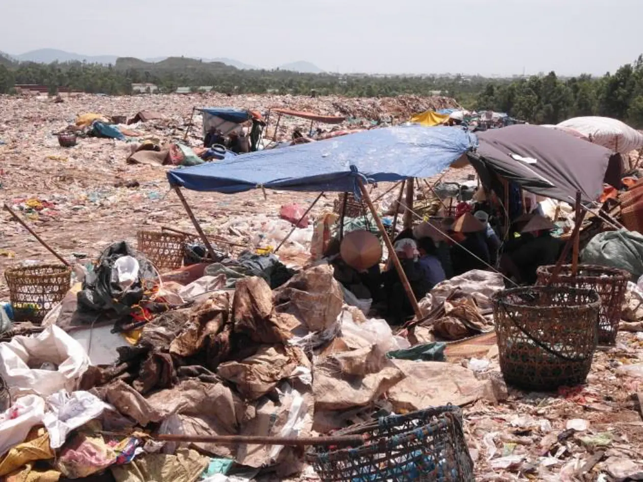
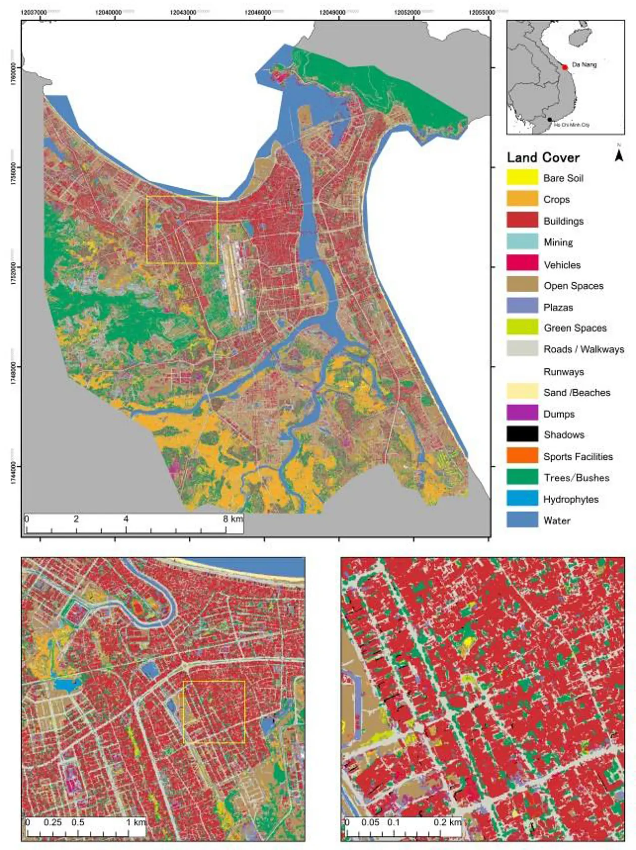
A research consortium of twelve project partners develops a planning methodology for the infrastructure-sectors of energy, water, sewage, solid waste and urban agriculture. The method is directly tested and implemented in the dynamically evolving case cities of Kigali (Rwanda), Da Nang (Vietnam) and Assiut (Egypt). Frankfurt am Main (Germany) is used as a reference city, which provides experience in environmentally urban and infrastructure planning for the development of the methodology. The project partners provide municipalities with a "Rapid Planning Toolbox", in which results, experiences and suggestions for planning solutions are combined. An important goal within the project is the transferability of the developed methodology to other cities.


The Geoinformatics Group at the Geographical Institute has the task to recognize various types of urban structures using high-resolution satellite data. For these types of urban structures socioeconomic basic values such as household income of a family are recorded and calculated for the whole city. This provides initial planning data to estimate supply and demand values for energy, water, sewage, waste and urban agriculture. In addition, the researcher are building a spatial database in order to provide basic geodata for all case cities and project partners.


Contact information:

Dr. Felix Bachofer

Phone: +49 7071-29-77528

felix.bachoferspam prevention@uni-tuebingen.de

Andreas Braun (MSc.)

Phone: +49 7071-29-78940

an.braun@uni-tuebingen.de

University of Tübingen

Faculty of Science

Geoinformatics Group

Rümelinstraße 19-23 (W402)

72070 Tübingen

Project-Homepage