Ammer Valley Surface Layer Measurement Network
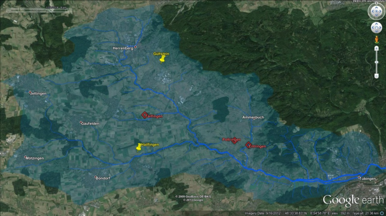
Three sites in the Ammer Valley, in Baden-Württemberg (southwest Germany), have newly installed meteorological ground stations. The Ammer Valley creates moderately-complex terrain, and it is characterized by high land-use heterogeneity: residential, agricultural, and forested lands, within 240 sq.km. The station sites were selected for geographic, soil, and plant diversity.
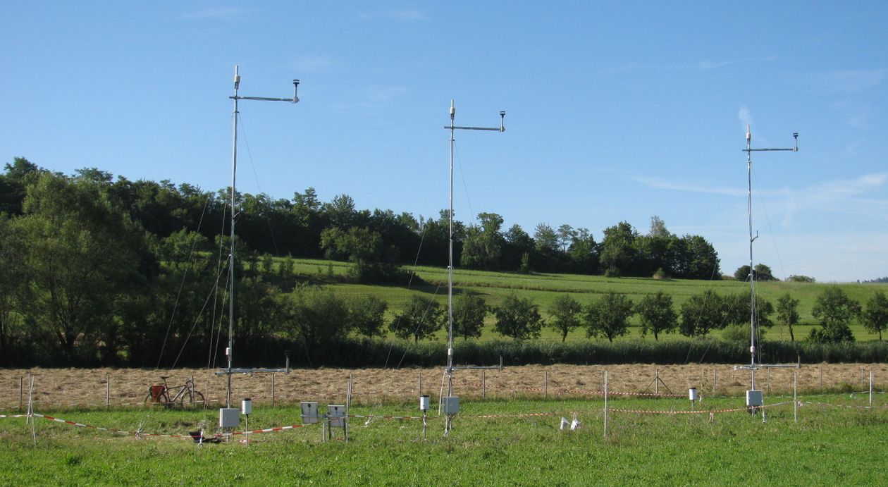
The stations' instrumentation was designed to use the flux-gradient technique for measuring surface layer momentum, heat, and moisture fluxes. Using the flux-gradient method, estimated surface layer fluxes are being compared to an eddy covariance system. Eddy covariance systems are the standard instrument for measuring energy fluxes. The eddy covariance system is moved between the sites, in order to allow for flux comparisons for a variety of conditions. One motivation for investigating a flux-gradient measurements is the high cost of an eddy covariance system. With two heights and using 2-dimensional sonic anemometers, a flux-gradient station is approximately an order of magnitude less expensive than one eddy covariance system. This means that for the same price as a single point measurement from one eddy covariance system, an entire network of flux-gradient stations (à la the Ammertal Network) could be installed instead. The efficacy of a such a network is being researched.
Besides instruments for flux-gradient measurements, each site has a net radiometer, soil heat flux plates, and sub-surface temperature and moisture sensors up to 1.5 m deep, all of which provide additional measurements for surface fluxes. Three stations were initially setup during the winter of 2013-2014, and have been continuously modified to improve measurements.
This project also provides the basis for collaborative research in atmospheric, soil, and plant interactions. All of the data is collected and stored in a single database, accessible via the computer network of the University of Tübingen. There is also a website for displaying recent data, which is being developed for self-serve data downloads. As of June 2015 approximately 15 other projects, from several academic disciplines, have used data from the Ammertal Network.
The Link to the real data of the Ammertal Network:
https://www.geo.uni-tuebingen.de/projekte/wess/
