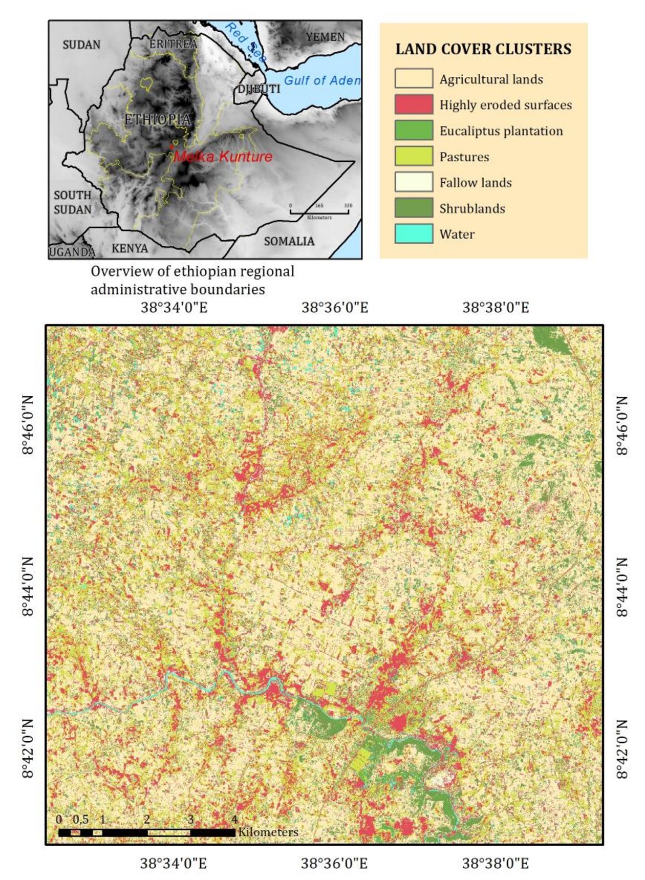
The project is a bilateral project between the Chair of Geoinformatics, University of Tuebing-en with the Charles University Prague. The contribution of Geoinformatics in Tuebingen con-sisted in the analysis of remote sensing data and high-resolution topographic data in order to assess the dynamics of mass wasting and soil erosion in the Jemma River Basin and in the Upper Awash catchment. The spatial resolution of the digital elevation models available range between 2 and 250 meters, this enables to map the erosion very well at different scales for dif-ferent targeted purposes. ALOS PRISM (ESA 13160) stereo triplet where used in order to de-rive topography at a 10 meter resolution and to derive topographic indices for the erosion as-sessment of moderate sized sub-catchments in the Jemma River Basin (Andit Tid, Debre Beh-ran). A preliminary land cover map was derived from RapidEye imagery, from the Grant RE-SA 133 in order to derive the soil erosivity and other parameters useful for the assessment of the areal erosion processes. The accompanying map shows a preliminary Land Cover Map, which allowed us to cluster and classify the most vulnerable erosion areas in a study site of the Upper Awash catchment (Melka Kunture).
