The Urban Street Network of Ancient Rome. Administration, Archaeology and Topography

Ca Foscari University of Venice (Italy)

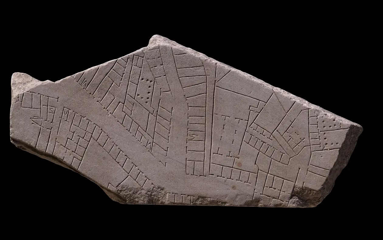
Until recently, archaeologists have paid little attention to the urban street network within the Aurelian Walls. This lack of interest it is in contrast with the strong interest for the extramural roads that connect Rome with the other roman cities. This observation is unexpected, particularly if we consider that the urban streets covered the vast majority of space devoted to public uses.

The research intends to fill the void in studies of ancient streets of Rome, by providing on overview on the topic from several points of view.

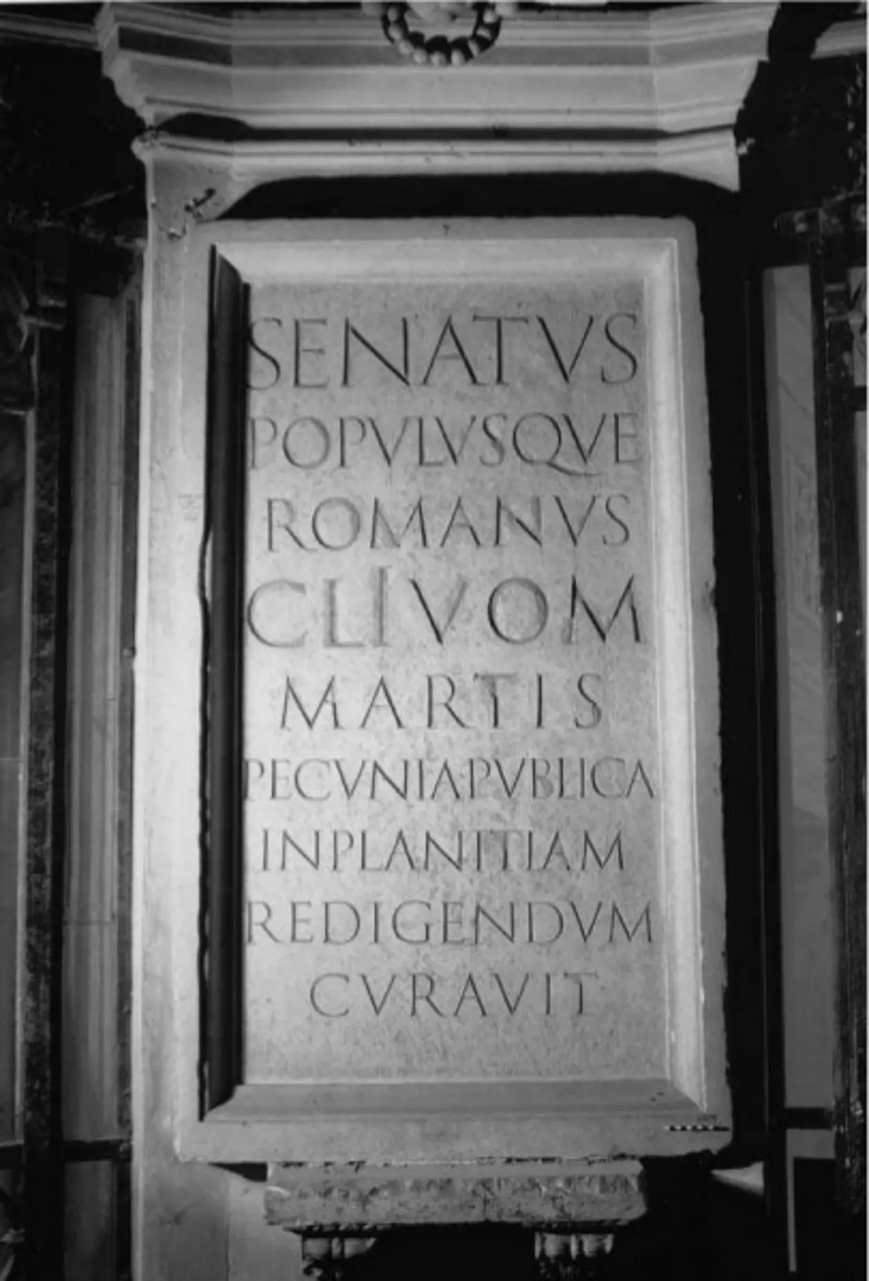
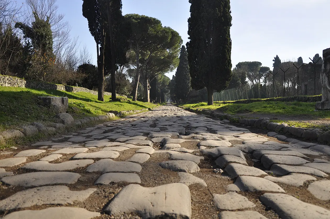
The work has been divided in three sections. In the first one, dedicated to the administrative aspects over a long time span (Vth BC - IVth AD), the management of the roads, the roles of the magistrates appointed and their funding will be analyzed in depth. Furthermore, I will investigate the legal and regulatory aspects of the roads – and their connection with the private property – and the peculiar odonimic system of Rome. The technological changes in the road building, documented by archaeological evidences, will be explored in the second section.

In the third one, the attention will be shifted to the topographical aspects. I will investigate two crucial areas of the ancient city: 1) the forum Boarium and Holitorium; 2) the Campus Martius, taking into account all the elements that influenced the street network (such as gateways and bridges). The gathering of published and unpublished data constitutes the basis of this second section The archaeological bulletins focused on the excavations of Rome – Bullettino della Commissione archeologica comunale di Roma, Notizie degli scavi di antichità, Fasti Archeologici, Bullettino dell’Istituto di corrispondenza archeologica) and other handwritten documents (the clipboard of Rodolfo Lanciani stored at the Biblioteca Apostolica Vaticana, those of Giuseppe, Edoardo e Guglielmo Gatti and some specific sections of the Archivio Centrale di Stato) – contain a boundless volume of data, never collected before, that will be organized in a systematic way. Simultaneously, the graphic documentation available (drawings, maps of excavations) will be acquired in raster format, in order to be overlaid on the modern cadastral map of Rome. To organize all the data, a GIS will be used. It will allow to output thematic cartography, distinguishing the layouts by their chronology or by other specific features.

The final goals are, on one hand, to provide an up-to-date overview on the constantly changing administration system; on the other hand, to reconstruct – through the correlation of archaeological, textual and iconographic sources – the ancient street network of these important neighborhoods of ancient Rome.

Kontakt:
Dr. Riccardo Montalbano
Dipartimento di Studi Umanistici, Dorsoduro 3484/D,
30123 Venezia
 +39 320 90 76 001
ricca.montalbanospam prevention@gmail.com

Betreut durch:
Prof. Dr. Johannes Lipps