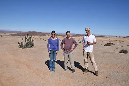
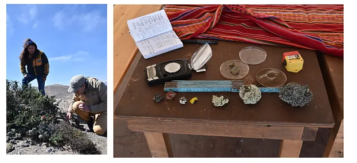
In August 2023 a field campaign was executed in the Atacama Desert of Northern Chile to plan a research project on structure, function and dynamics of fog driven ecosystems in this hyperarid environment.
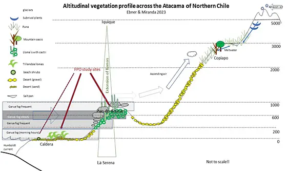
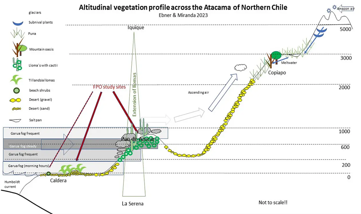
Analysis of vegetation pattern of Northern Chile aimed at identifying study areas for research on fog plants. We analyzed landscape and vegetation structure along a stretch from La Serena to Iquique (approximately 2000 km long) focused on the coastal cordeliere. We confirmed the overall picture (Fig. 1).
That the climate conditions, derivable from vegetation cover a) change gradually from semiarid to hyperarid conditions towards the North and b) there is a zone of increased vegetation cover in the ocean directed escarpment of the coastal cordillera between 600 and 900 m altitude, clamped between the beachline and the hyperarid inter valley.
The intervalley between the coastal cordilleras and the volcanoes of the high Andes proved to be almost devoid of permanent higher plants. Higher evaporation rates in ABFLUSSLOSE BECKEN generate salt pans. Tree covered areas like the TAMURUGAL owe their existence to groundwater originating from high altitudes of the Andes.
In higher altitudes directed towards the central cordeliere vegetation cover reappears due to lower saturation deficit of the atmosphere, which lowers water stress. This Puna vegetation is dominated by herbs (and grasses) Vegetation cover gets denser and woodier along river systems fed by snow fields of the Andes.
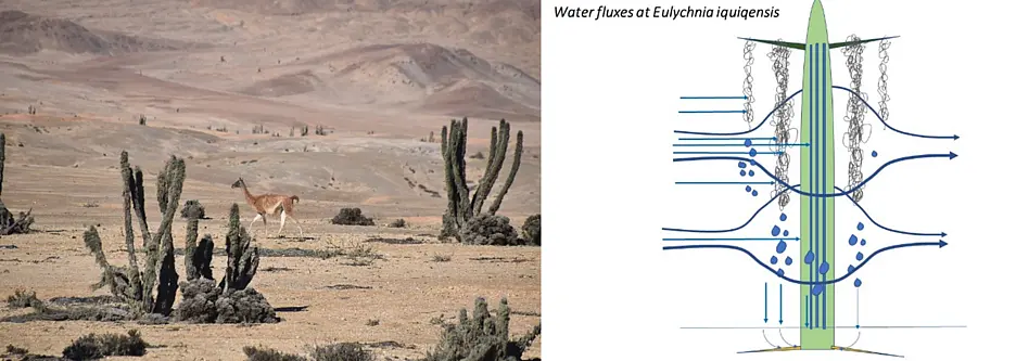
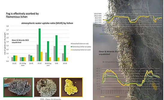
The vegetated stripe located within the coastal cordillera is of particular interest for this project aimed at fog driven ecosystems, as its presence is related to the attitude range where low clouds which formed above the cold Humbold current (and thereafter drawn towards to the low-pressure cells of the heated land mass) hit the coastal cordillera. During the longitudinal transect we studied during the field campaign we confirmed that the coastal cordeliere above 300 m is frequently affected by fog. This fog reevaporates abruptly at the device towards the hyperarid inter valley within a distance of less than 50 km. From the North in Iquique to Caldera further South the lower boarder of fog impact seems to decline almost to sea level, as permanent vegetation dominated by cacti are as well present in the littoral plain. Near Pellegrini.
A study site representative for the situation in the transition between semiarid and hyperarid section of the Coastal cordillera in the Northern Atacama is the National Parc Pan the Azúcar. A steep escarpment arises from the coastline to an altitude of 700 m. From there a 15 km plateau slightly descends towards the continent cut by a riverbed which brings meltwater from the high Andes to the coast. The escarpment line is affected by fog originating from clouds rising at the coastal slopes.
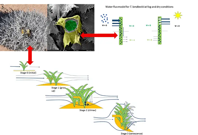
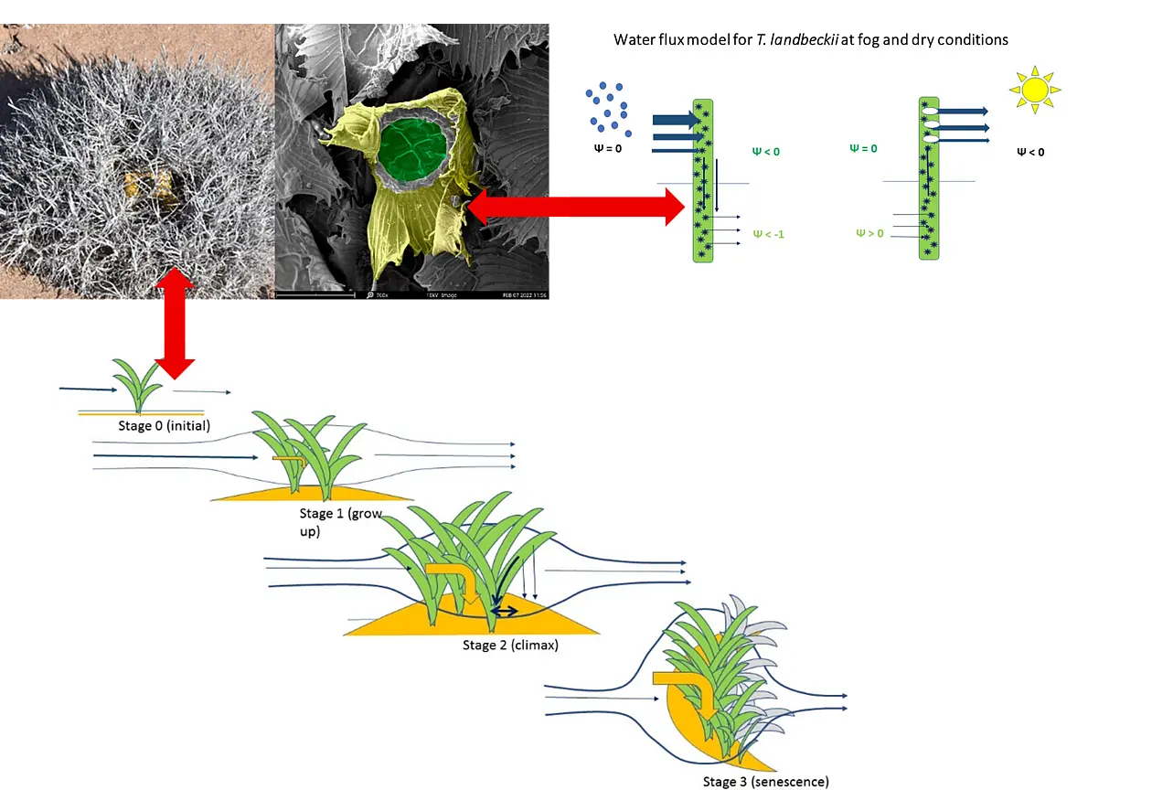
10 km North of Caldera a broad valley cuts the coastal cordillera giving rise to a continuously rising corridor which cuts into the mountain ranges on a distance of 50 km to an altitude of 800 m. The ground of this valley is covered by sand. Around 20 km from the coast at 200 m altitude, the valley ground is covered by fields (intensively settled by tussocks) of T. landbeckii.
