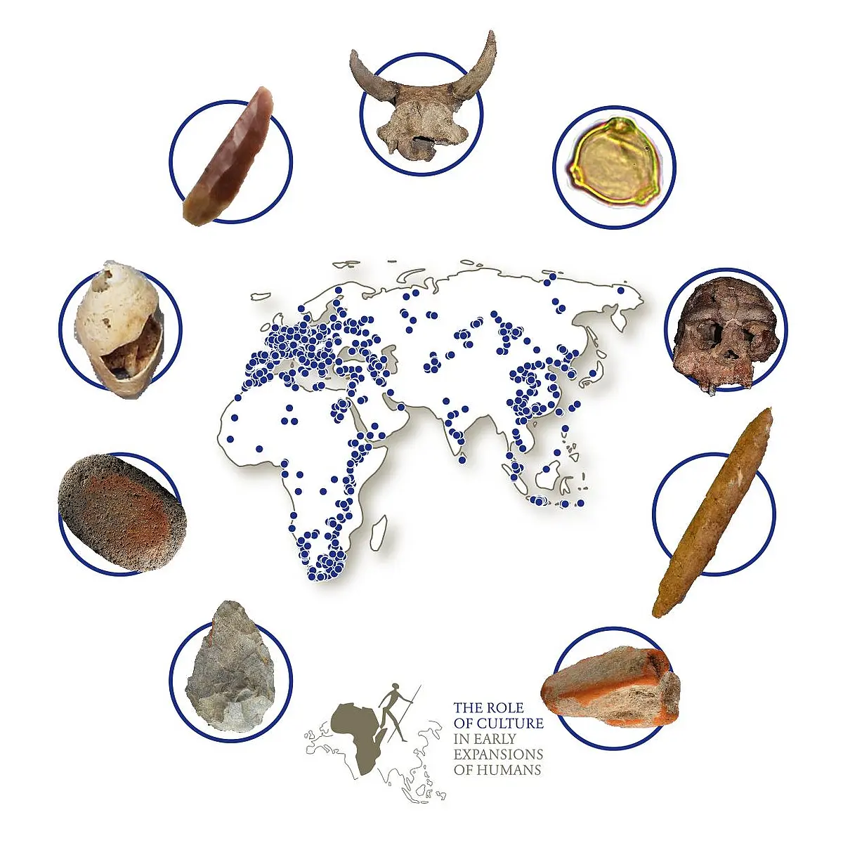
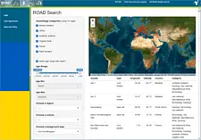
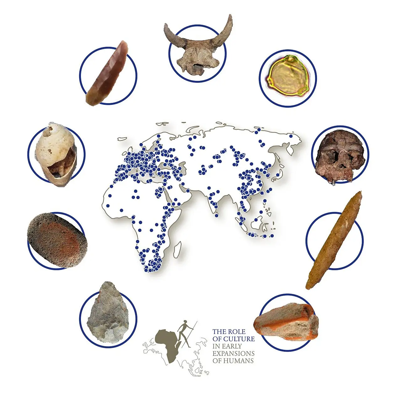
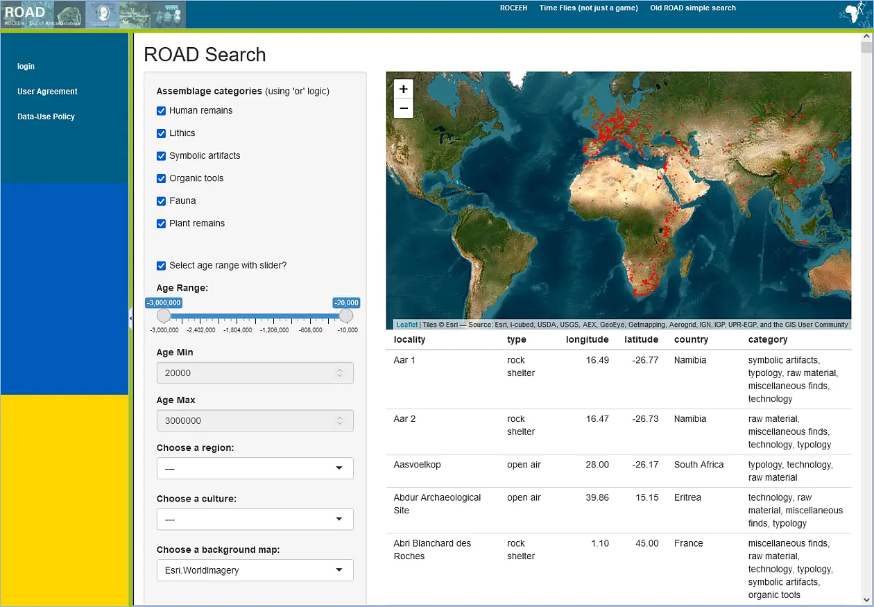
ROCEEH
The Role of Culture in Early Expansions of Humans, 2008 - 2027
During the last two million years, the geographic range of the human species expanded in several waves from its original African homeland to encompass Eurasia – and possibly back into Africa.
Of these hominin species, only anatomically and behaviorally modern humans, Homo sapiens sapiens, have been able to overcome the impediments imposed by the physical geography of this planet. Within a few tens of thousands of years, modern humans successfully inhabited the globe, settling in Australia, the Americas and even the polar regions.
Research on Human Migration
The project "Role of Culture in Early Expansions of Humans" (ROCEEH) investigates the phenomenon of early hominin migration from different angles:
- Cultural evolution based on tools and art
- Reconstruction of habitats, paleobotany and paleolandscapes
- Biological, cognitive and social evolution
Geographic methods, like GIS & modelling, are used to link these spatio-temporal phenomena and create new insights.
The longterm project has a lifetime of 20 years (2008-2027) and is funded by the Heidelberg Academy of Sciences and Humanities. It teams up researchers from the University of Tübingen and the Senckenberg Research Institute, Frankfurt/Main.
ROCEEH Out of Africa Database
The "ROCEEH Out of Africa Database" (ROAD) is a tool for researchers to store, request and visualize data related to human expansion processes. We integrated paleoanthropological and cultural information, vegetation history, paleontological and paleoecological data, climate records, stratigraphical settings, age models and geophysical and geomorphological information. Furthermore, ROADweb was developed in order to make application of the complex database as simple as possible.
Geodata Catalogue
With the proceeding of the project, the amount of geodata is constantly growing. We implemented a Geo-Metadata Catalogue to...
- store metadata (Filetypes, Date of Creation, Author, etc)
- simplify sharing of data (and make sure everyone has the latest version)
- save time using search functions
- have a central data storage
- have an overview who processed the data for which purpose
The ROCEEH GeoNetworks can be accessed here.
Landscape Reconstruction
Another focus of our working group within the project lies on the recostruction of paleolandscapes using Geomorphology, GIS and Remote Sensing techniques. After research at f.e. Lake Manyara (Tanzania) or the archeaological site of Melka Kunture (Ethiopia) we currently set an aditional focus on investigations in eastern South Africa. We use recent geomorphological processes to reconstruct landscape dynamics and landscape evolution around the Cave of Sibudu (Tongati River) and the Upper Drakensberg Mountains.