Fachbereich Geowissenschaften

Physics-Based Modelling of Erosion at Catchment Scale

How do physics-based hydrological models improve the prediction of landscape evolution and thus the formation of the catchment in geological time scales?

PhD Researcher: Karim Norouzi Moghanjoghi
Supervisors: Todd Ehlers (University of Tübingen), Chuanhe Lu (University of Tübingen), Martin Ross (University of Waterloo)

Motivation

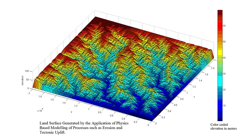
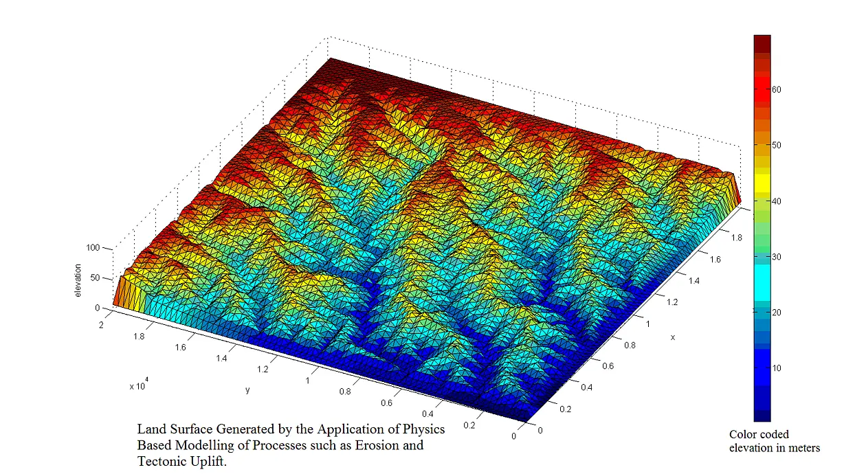
The evolution of Earth’s topography is commonly thought of as a balance between tectonic processes that produce topographic relief, and climate (through the process of erosion) that sculpts topography. The effects of near surface transient hydrologic and biologic processes on landscape evolution are, unfortunately, commonly ignored. In the last two decades, increasing interest has emerged to quantify the evolution of topography with physically based landscape evolution models. Recent cross-disciplinary enthusiasm to develop improved landscape evolution models is motivated by several factors, including: the need to predict changes in erosion and sedimentation rates in response to global warming scenarios; increased concern over soil loss; and to test the hypothesis that climate and tectonic processes are coupled through erosion and sedimentation.

Hydrosystem Modelling

The Earth’s surface is an important and evolving boundary condition for hydrosystem models. Existing landscape evolution models provide only a primitive (steady-state) coupling with hydrologic models. As a result the influence of transient fluid flow and climate variability on mass transport at the Earth’s surface is poorly understood, despite its potentially broad reaching implications for landscape development and water quality. In turn, thickness variations of unconsolidated sediments throughout a catchment that are consistent with its geomorphological evolution are expected to be an important trait of a catchment, but are in current physics-based modelling approaches only indirectly considered.