Late Bronze Age Tell Atchana
Dr. Simone Riehl
Archaeological setting and environment
The 22ha mound of Alalakh or modern Tell Atchana is situated in the Amuq valley of Southern Turkey, 12 km East of Antakya. It represents one of 178 sites recorded on a survey by R. Braidwood in the 1930s. Sir Leonard Woolley, who started to excavate the tell between 1936 and 1949 mainly concentrated on its western part, where he found palaces with Akkadian cuneiform archives and other objects demonstrating Alalakh’s importance for intercultural contacts to all the different polities in the area from the Middle Bronze Age onwards.
At the end of the Middle Bronze Age (c.1600 BC) the Hittites destroyed Alalakh amongst other cities during their attacks to Yamkhad. Abundant textual and material culture evidence is available at Late Bronze Age Alalakh IV (c.1400 BC). Level IV at Alalakh dates to the period of the rule of the Mitanni Empire and was destroyed by the Hittites. Architectural structures of level I are related to the period of Hittite dominance. Despite the succession of empires in this region, local material culture traditions remained predominant. However, there are distinct regional differences, related to social and political organization, that may have also found expression in the economy (Akkermans 2003).
The neighboring site of Tell Tayinat may have been in a certain economic and/or socio-political relation to the Atchana settlement, probably in a landscape strongly differing from that today, by another course of the Orontes river (cf. Casana 2003).
The new excavations by Prof. Aslıhan Yener, Dr. David Schloen, Amir Fink and their international team concentrate on buildings and other archaeological structures in the southeastern part of the mound.
So far, there are at least some results on the shape of the prehistoric landscape and palaeoenvironmental conditions for the prehistoric societies in the area by Yener et al. (2000), who conducted relevant research between 1995 and 1998 with the Amuq valley regional project.
Today the close location of Atchana to the Mediterranean coast brings a relatively high amount of rainfall (500-700 mm/y), which enables rain-fed agriculture in any case. Beyond these favorable conditions, irrigation is practised to improve crop yields. High floods of the Orontes river occur sometimes between February and March. Wilkinson concluded from the colluvia, that erosion must have taken place during the Early Bronze Age period already (Wilkinson in Yener et al., 2000 p. 168-179).
At Tell Atchana Woolley demonstrated that the plain level must have risen at least about 5m since the 3rd millennium. The Lake of Antioch was a swallow lake during the late 1930ies, and Wilkinson concludes a gradual increase in lake level through the second to the first millennium BC, which coincided with the aggradation of the Orontes floodplain, as already suggested by Braidwood. During the early-mid Holocene a lake or some kind of slow moving bodies of water must have existed, as corings indicate by shelly clays in several areas. The evolution of the Lake of Antioch has to be dated after ca. 3000 BC, as the Amuq G occupation phase, are covered by lake sediments. Wilkinson suggests a nonexistent or greatly diminished lake in the late fourth and third millennia BC, and a rising lake from the first millennium onwards. The marshland was according to Wilkinson not formed until after the late Roman period. The same developments were observed to have taken place at Gölbaşı Lake. The processes recognized in the lake baisins coincide with higher-energy floods in the Orontes and from the Amanus mountains, i.e. “lake development may have resulted from the arrival of increasingly large floods into the basin” (Wilkinson in Yener et al., 2000, p.178). The origin of this positive water-balance is interpreted to be of climatic nature. Wilkinson further speculates that either rainfall was higher at this time, as reported in the southern Levant or storms were more frequent. Moist phases are recognized in the Dead Sea and Lake Kinneret levels around 2000 BP (Frumkin et al., 1994), and in Eastern Syria at Lake Khatouniye (Rösner and Schäbitz, 1991). Also human influence via deforestation has to be taken into consideration.
Wilkinson’s overall picture of the Holocene plain is that of a more or less dry environment with numerous springs contributing “to patches of marsh and even small lakes, which would have provided a rich mosaic of wet and dry environments at all times throughout the Holocene” (Wilkinson in Yener et al., 2000, p.179).
Generally palaeoenvironmental research (isotopy and palynology) is still very fragmentary in the Near East and the Eastern Mediterranean (Goodfriend, 1999) and mostly covers older sequences of the Holocene (e.g. Rossignol-Strick 1999, Frumkin et al. 1999 or Bar-Matthews et al., 1997). There are also massive problems with the chronological resolution, which disable the correlation of environmental change or climatic events with archaeological periods from the Bronze Age onwards. Correlation of profiles from different regions is often impossible, because of very distinct local differences in sedimentation rates. Chronological problems, particularly for the mid Holocene onwards, become also obvious for the detailed palynological results of the vegetation development for different regions of the Near East (van Zeist and Bottema 1991, Bottema 1986). Dense 14C-dating of the upper strata of a pollen profile is very rare. The degree of anthropogenic influence is difficult to assess for the different regions. Beside this there are other methodological problems, such as a lack of locations suitable for pollen analysis, or the problem of recognition of anthropogenic factors in the pollen diagrams (cf. Behre 1990).
For the Holocene development in the closer neighborhood of Atchana there is palynological information from the Ghab valley of the Orontes river (NW Syria) (van Zeist and Woldring 1980). Unfortunately there are too few and partially controverse 14C-data that make it difficult to specify anthropogenic influence (between ca. 3200 und 2000 BC). Even worse is the fact that the palynological research conducted under the Amuq Valley Project only detected very fragmentary preservation of pollen grains, which do not allow any reconstruction of vegetation development (pers. com. Henk Woldring).
Archaeobotanical research goals at Tell Atchana
The main challenges for the archaeobotanist are to explain the interrelationship between changes in plant production and land use systems, and the environment in which they are embedded in.
In consideration of the aim to find single records for the interrelated multiple little events resulting in cultural and environmental change, the following research aims can be defined.
-
On the basis of the crop spectrum and proportions, it is of interest under which conditions the crops were grown, and which general agricultural techniques were used (e.g. irrigation, manuring, weeding etc.).
-
A factor of socio-economic importance is the identification of labor and activity patterns, i.e. how and where crop-processing and storage were conducted within the whole settlement.
-
Another important aspect to bring light to ancient social structures within the urban site, is to investigate whether there were social differences between different areas within the settlement (i.e. the composition of the storage and/or diet in domestic and palatial areas).
-
Related to the last two points, but of wider political dimension is the investigation of indication for the receipt of crops either from neighboring regions or from trade, and whether there are any signs of redistribution.
-
For a complete reconstruction of the subsistence economy it is necessary not only to focus on plant production and gathering, but also to investigate how these results correlate to animal production and hunting. Questions of interest do not only comprise such as to the different proportions of plant and animal products in the daily diet but also whether domestic animals were fed on crops.
-
The environment and its development under anthropogenic influence and other natural factors, is also focus of archaeobotanical investigation, as it defines the possibilities of cultural development during different periods.
-
Having answered the mentioned questions for a specific period it will be of interest to discover variation of patterns over time (e.g. which differences in plant production can be recognized from the Middle Bronze to the Iron Age at Tell Atchana), and how they compare to other relevant sites (e.g. the architectural similarities of the level IV palace in Atchana with the remains at Emar offer a profound possibility to compare the archaeobotanical remains of both sites).
Methods
Archaeobotanical sampling of the newly excavated areas started in 2003, and was continued during the excavation campaign 2004.
Students (Katrin Hieke and Özgür Çizer) from the Institute of Prehistory, University Tübingen helped with the on site flotation and coarse sorting of samples in the field. Subsampling and final sorting was also partially conducted by a student from the Institute of Prehistory, University Tübingen (Sven Fiedler).
Samples at Atchana were taken as a combined sampling strategy of systematic and judgemental sampling, i.e. samples were taken in each finegrid, where possible and from various visible contexts such as hearths, pits, etc. and noticeable discolorations. Standard sample size was 32 litres, where possible.
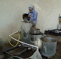
The sediment was processed with a very powerful “Ankara type” flotation machine, which was built in 2004.
The samples were transported for analysis to the Archaeobotanical Laboratory (Institute of Prehistory, University Tübingen).
For efficient sorting (i.e. separation of carbonized from uncarbonized light remains) the samples have to be separated by dry sieving into different fractions (1mm, 0.63mm and 0.18mm). Typical remains of the 1mm fraction are cereal grains, crop pulses and charcoal. Most of the wild plant taxa are recovered from the smaller fractions. These are usually very large, and have to be subdivided in order to sort them in a reasonable amount of time. Subsamples of 1/8 to 1/2 were taken with a riffle type sample splitter according to criteria that ensure their statistical relevance (van der Veen 1982).
Sorting was conducted with an Euromex binocular under 10- to 30-fold magnification using soft tweezers.
Identification was conducted with the comparative collection of the Archaeobotanical Laboratory (Institute of Prehistory, University Tübingen) and the relevant identification literature compiled by Jensen (1998).
Approaches, results & conclusions
In orientation to the research goals mentioned above, the following approaches are used in the study of the archaeobotanical material from Tell Atchana.
-
In order to gain some information on the conditions of plant production, the identification of wild plant species holds a key role. The approach includes the application of descriptive and multivariate statistics together with the information on weed ecology. Another new method to detect growing conditions of crop plants is the analysis of stable carbon isotopes in carbonized prehistoric crop taxa.
-
Finds of storage facilities are rarely undisturbed (one of the exceptions are the silo finds at Bogazköy (Neef 2001)). Very often patterns are not so clear in the archaeological record, and even more vague are locations of crop-processing. Simple statistical methods, but also more sophisticated multivariate statistics enable the archaeobotanist to detect probable storage locations and crop-processing patterns (Jones 1987).
-
With a considerable amount of plant remains from a site, different social patterns can be investigated by the analysis of proportions of different crop plants in different areas. The necessary precondition for this approach is a systematic sampling of a large excavated area with a broad spectrum of different settlement structures.
-
The origin of crop plants from different growing locations may be reflected in their stable isotopes (carbon and strontium). Such studies are still very rare and basic research is still to conduct, but the results so far achieved are very promising (see Riehl and Pustovoytov this volume). Another branch of information may be the comparison of the spectra and proportions of crop taxa to other sites in the closer neighborhood.
-
An interdisciplinary consideration of the plant remains and animal bones is necessary to reconstruct a complete picture of subsistence and agricultural economy, and is one of the archaeobiological aims within the new excavations at Tell Atchana. Questions such as whether domestic animals were fed on crops can be answered by the analysis of dung remains, but eventually also by stable isotopes on animal bones. But also for the latter approach basic research still has to be conducted.
-
The reconstruction of the prehistoric environment is possible with archaeobotanical means, more precisely through the wild plant flora as distinct from the weed flora. Not only seeds from wild plants, but also charcoal remains provide good possibilities to reconstruct the ancient environment. Anthracological research is especially crucial in areas were pollen preservation is too bad to reconstruct the dynamics of woodland. Beside the classical investigation of the composition of the woodland vegetation, methods of quantifying the amount of woodland through time are applied, which are based on the hypothesis that with a decrease in wood for fuel, an increase in the use of dung takes place, which would be represented in the ratio of wild plant seeds to charcoal remains (e.g. Miller et al., 2000). Aside from various methodological problems (starting with the often questionable identification of dung contexts as to problems of quantification of charcoal) this kind of approach can at least be used as an additional source of information. Ecological classification of the identified plant remains in multivariate applications will enable to conduct environmental pattern searching (Riehl in prep.). Charcoal analysis at Tell Atchana and several other sites in the larger area (Kinet Höyük, Tell Mishrife, Tell Mozan, Emar) is conducted by Katleen Deckers within a joint archaeobotanical-geoarchaeological project at the University Tübingen.
-
The chronological aspect, i.e. the comparison of the detected patterns from different periods will be conducted by basic descriptive and comparative statistics on the data available from other sites in the region. Comparisons with the results from the neighboring site of Tell Tayinat, which is archaeobotanically investigated by Prof. Catherine D’Andrea and her team, promise to shed new light on the political and social relations of the two settlements during the different periods. In this relation the Atchana project will also profit from other research projects of the authors, investigating Bronze and Iron Age environmental and economic change in the area of the Northern Levant and Northern Mesopotamia (Deckers 2004).
Part of the material is subject to a master’s thesis at the institute.
Riehl, S. 2010, Flourishing agriculture in times of political instability – the archaeobotanical and isotopic evidence from Tell Atchana. Chapter 10, in: Kutlu Aslihan Yener (ed.), Excavations in the plain of Antioch. Tell Atchana, Ancient Alalakh, a Bronze Age capital in the Amuq Valley, Turkey. The 2003-2004 excavation seasons. 123-136. [pdf]
Conclusion
With mainly free-threshing wheat and barley, the cereal crop spectrum is typical for the region, whereas the presence of grape, olive and the spectrum of wild species are consistent with a typical Late Bronze Age Mediterranean archaeobotanical assemblage.
Despite the difficult taphonomic situation, the original associations of the plant remains are still recognizable with the application of correspondence analysis, and represent storage and cooking remains, dung remains and crop-processing by-products, although the latter are only sparsely represented with their actual counts.
A broad spectrum of ecological habitats is represented amongst the wild taxa, including moisture indicating and woodland species, as well as such from dry open habitats. In general, the anthracological results seem to match well the potential vegetation reconstruction. Admittedly, the sample is very small though provides already a picture of what might have been growing in the region. Future research needs to establish the regional composition of the woodland vegetation.
Further research will focus on the aims outlined above, with large volume sampling from all kinds of contexts and different periods at Atchana.
Acknowledgements
We would like to thank the excavators Prof. Dr. Aslihan Yener, Dr. David Schloen and Amir Fink for their kind invitation to join their multidisciplinary research project, and for their support with archaeological and technical questions on site.
Thanks to the German Research Council (DFG) it was possible to finance the sorting by Sven Fiedler, Katrin Hieke and Özgür Cizer. The anthracological work by Katleen Deckers was possible with financial support by the “Structural Fond” of the University Tübingen.
Bibliography
Akkermans, P. M. M. G. and G. M. Schwartz (2003). “The archaeology of Syria. From complex hunter-gatherers to early urban societies (ca. 16000 - 300 BC).” Cambridge, Cambridge University Press.
Bar-Matthews, M., Ayalon, A., and Kaufman, A. (1997). Late Quaternary paleoclimate in the Eastern Mediterranean region from stable isotope analysis of speleothems at Sorq Cave, Israel. Quaternary Research 47, 155-168.
Baxter, M. J. (1994). "Exploratory multivariate analysis in archaeology." Edinburgh University Press, Edinburgh.
Behre, K.-E. (1990). Some reflections on anthropogenic indicators and the record of prehistoric occupation phases in pollen diagrams from the Near East. In "Man's role in the shaping of the eastern Mediterranean landscape." (S. Bottema, G. Entjes-Nieborg, and W. van Zeist, Eds.), pp. 219 - 230. Balkema, Rotterdam.
Bottema, S. (1986). A late Quaternary pollen diagram from Lake Urmia (Northwestern Iran). Review of Palaeobotany and Palynology 47, 241-261.
Bottema, S., and Woldring, H. (2001/2002). The vegetation history of East-Central Anatolia in relation to archaeology: the Eski Acigöl pollen evidence compared with the Near Eastern environment. Palaeohistoria 43/44, 1-34.
Bottema, S., Woldring, H., and Aytug, B. (1986). Palynological investigations on the relation between prehistoric man and vegetation in Turkey: Beysehir occupation phase. In "OPTIMA. Proceedings of the fifth meeting." (H. Demeriz, and N. Özhatay, Eds.), pp. 315 - 328. Istanbul Üniversitesi, Fen Fakültesi, Istanbul.
Casana, J. (2003). "From Alalakh to Antioch: Settlement, land use, and environmental change in the Amuq valley of Southern Turkey." Unpublished PhD thesis, University of Chicago.
Deckers, K. and S. Riehl (2004). The development of economy and environment from Bronze Age to the Early Iron Age in Northern Syria and the Levant. A case-study from the Upper Khabur region. Antiquity 78 (Project Gallery): 302.
Engel, T. (1993). Charcoal remains from an Iron Age copper smelting slag heap at Feinan, Wadi Arabah (Jordan). Vegetation History and Archaeobotany 2, 205 - 211.
Engel, T., and Frey, W. (1996). Fuel resources for copper smelting in antiquity in selected woodlands in the Edom highlands to the Wadi Arabah/Jordan. Flora (Jena) 191, 29-39.
Frey, W., Jagiella, C., and Kürschner, H. (1991). Holzkohlefunde in Dur-Katlimmu/Tall Šeh Hamad. In "Die rezente Umwelt von Tall Šeh Hamad und Daten zur Umweltrekonstruktion der Assyrischen Stadt Dur-Katlimmu." (H. Kühne, Ed.), pp. 137-161. Dietrich Reimer, Berlin.
Frumkin, A., Carmi, I., Zak, I., and Magaritz, M. (1994). Middle Holocene environmental change determined from the salt caves of Mount Sidon, Israel. In "Late Quaternary chronology and palaeoclimates of the Eastern Mediterranean." (O. Bar- Yosef, and R. S. Kra, Eds.), pp. 315-332. University of Arizona Press, Tucson.
Frumkin, A., Ford, D. C., and Schwarcz, H. (1999). Continental oxygen isotopic record of the last 170.000 years in Jerusalem. Quaternary Research 51, 317-327.
Goodfriend, G. A. (1999). Terrestrial stable isotope records of Late Quaternary paleoclimates in the eastern Mediterranean region. Quaternary Science Reviews 18, 501-513.
Gremmen, W. H. E., and Bottema, S. (1991). Palynological investigations in the Syrian Gazira. In "Die rezente Umwelt von Tall Šeh Hamad und Daten zur Umweltrekonstruktion der Assyrischen Stadt Dur-Katlimmu." (H. Kühne, Ed.), pp. 105-116. Dietrich Reimer, Berlin.
Jensen, H. A. (1998). "Bibliography on seed morphology." Rotterdam, A. A. Balkema.
Jones, G. (1987). A statistical approach to the archaeological identification of crop processing. Journal of Archaeological Science 14: 311 - 323.
Kühne, H. (1991). Die rezente Umwelt von Tall Šeh Hamad und Daten zur Umweltrekonstruktion der Assyrischen Stadt Dur-Katlimmu. Dietrich Reimer, Berlin.
Miller, N. F., Schwartz, G. M., Curvers, H. H., Gerritsen, F. A., Maccormack, J. A., and Weber, J. A. (2000). Plant remains. American Journal of Archaeology 104, 438-447.
Moore, A. M. T., G. C. Hillman, et al. (2000). "Village on the Euphrates: from foraging to farming at Abu Hureyra." New York, Oxford University Press.
Neef, R. (2001). Getreide im Silokomplex an der Poternenmauer (Bogazköy) - Erste Aussagen zur Landwirtschaft. Die Ausgrabungen in Bogazköy-Hattusa 2000. J. Seeher. Berlin - New York, Walter de Gruyter. 3: 335 - 341.
Pearsall, D. M. (2000). "Paleoethnobotany: a handbook of procedures." San Diego, CA, Academic Press.
Riehl, S. (1999). "Bronze Age environment and economy in the Troad: the archaeobotany of Kumtepe and Troy." Mo Vince Verlag, Tübingen.
Riehl, S. (2000). Erste Ergebnisse der archäobotanischen Untersuchungen am Tall Mozan/Urkesh. Mitteilungen der Deutschen Orient-Gesellschaft zu Berlin 132, 229 - 238.
Riehl, S. and K. Deckers (in press) Plant remains from Late Bronze Age Tell Atchana – Preliminary results from the 2003 excavations. American Journal of Archaeology.
Riehl, S. (in prep.). The significance of prehistoric weed floras for the reconstruction of interrelations of environment and crop husbandry practices during the Late Bronze and Early Iron Ages in the Near East. In "Ancient plants and people – contemporary trends in archaeobotany." (M. Madella, and M. Savard, Eds.). University of Arizona Press, Tucson.
Rösner, U., and Schäbitz, F. (1991). Palynological and sedimentological evidence for the historic environment of Khatouniye, Eastern Syrian Djezire. Paléorient 17, 77 - 87.
Rossignol-Strick, M. (1999). The Holocene climatic optimum and pollen records of sapropel 1 in the eastern Mediterranean, 9000-6000 BP. Quaternary Science Reviews 18, 515-530.
Ter Braak, C. J. F. (1994). Canonical community ordination. Part I: Basic theory and linear methods. Ecoscience 1, 127 - 140.
van der Veen, M. and N. Fieller (1982). Sampling seeds. Journal of Archaeological Science 9: 287-298.
van Zeist, W., and Bottema, S. (1991). "Late Quaternary vegetation of the Near East." Ludwig Reichert, Wiesbaden.
van Zeist, W., and Woldring, H. (1980). Holocene vegetation history and climate of Northwestern Syria. Palaeohistoria 22, 112 - 125.
Weulersse, J. (1940). "L’Oronte, étude de fleuve." Arrault et Cie, Maîtres Imprimeurs, Tours.
Wick, L., Lemcke, G., and Sturm, M. (2003). Evidence of Lateglacial and Holocene climatic change and human impact in eastern Anatolia: high-resolution pollen, charcoal, isotopic and geochemical records from the laminated sediments of Lake Van, Turkey. The Holocene 13, 665-675.
Willcox, G. H. (1974). A history of deforestation as indicated by charcoal analysis of four sites in eastern Anatolia. Anatolian Studies 24, 117 - 33.
Yener, K. A., Edens, C., Harrison, T. P., Verstraete, J., and Wilkinson, T., J. (2000). The Amuq valley regional project, 1995-1998. American Journal of Archaeology 104, 163-220.