Uni-Tübingen

Measuring the Inn Valley

Weather models lack data on the complex wind patterns in the mountains. Measurements taken by drones fill this gap.

The greatest risk occurred on the very first day in the skies: a glider circled the closed airspace over Kramsach in the Inn valley, and threatened to collide with the research drones. This was despite Andreas Platis having applied to air control at Innsbruck airport to have a three kilometer wide corridor closed for a whole month in order to take research measurements, and it being confirmed. Every glider or helicopter pilot should in fact always check before take-off to see if the airspace is clear. And now this: a yellow aircraft symbol on the laptop display in the ground station of Andreas Platis’ research group was clearly moving across the boundary.

‘Bring the drones down,’ Platis ordered the four pilots who were sending up the little propeller-powered flying machines by remote control on all four sides from the steep slope a little in front of him. The weather on this Sunday in June last year was beautiful, 30 degrees centigrade with cumulus clouds in a picture-book sky – no surprise therefore that amateur aviators wanted to make use of the favorable updrafts.

Two more gliders and a rescue helicopter followed on that day. ‘We called all the surrounding airfields and reminded them about the closure,” recalls Andreas Platis in his office at the University of Tübingen where he has now been analyzing the data they gathered on his computer over several months. ‘In the next four weeks there were hardly any more incidents,’ and his research group was able to measure the currents in the Inn valley with over 400 drone flights.

Every morning, two drones flew down the valley, and two up, each bearing a ‘backpack’ fitted with measuring equipment. The drones rose flying in parallel to a height of a 1,500 meters – far more slowly than weather balloons ever could. This meant they were able to gather high-resolution data on temperature, humidity, wind speed and turbulence and do so from a relatively low altitude. Higher up, at about three kilometers, colleagues from the University of Braunschweig measured the airspace with a research aircraft. In total, 200 researchers from 25 institutions from all over the world were involved in the project called “TEAM-X” led by the University of Innsbruck.


Weather models are currently unable to simulate currents in a mountain valley.


‘Until now, weather models have only been designed for flat terrain. They can’t map the flows in a mountain valley correctly. So weather forecasts don’t usually work so well in the mountains. With our research project we want to improve weather models in these complex terrains as well,’ says Andreas Platis. The Inn river flows powerfully down the valley, and the wind is likewise funneled through: in the morning blowing towards Germany, and in the evening back towards Liechtenstein. ‘However, in the middle of the valley it is far faster at 10 meters per second than on the hillside at 3 meters per second, because friction slows the wind between the mountain and the valley.’ This “horizontal shearing” of the winds causes turbulence, which in turn critically influences the weather.

In the coming years, there will be doctoral theses and numerous academic publications based on the data they obtained. ‘We can train current weather models with the data and thus improve the prediction of extreme weather such as storms in the mountains. It will also be easier to predict the speed with which fine particles from ground level are drawn upwards by turbulence,” says Platis.


In five years, weather forecasts in the mountains will be more accurate.


There were plenty of upsets even without erring gliders: storms would move down into the valley and all flights would have to be rescheduled – or alternatively, the daytime weather was so good that even at night interesting airflow conditions could be expected and make flights advisable. Or there was also the time when Martin’s cows escaped while the research group was staying on his farm. Since the drones were already waiting to launch, he asked them for help searching from the air.

‘In the beginning, the farmer and his wife were skeptical about our measurements,’ recalls Moritz Kippenberger, a PhD student on Andreas Platis’ team. ‘They were convinced that they knew the weather best themselves.’ But as the days passed, their curiosity and openness grew. ‘First of all, the children came, and then the 90 year old granny, and looked at what was going on, then farmer Martin and his wife Angelika.’

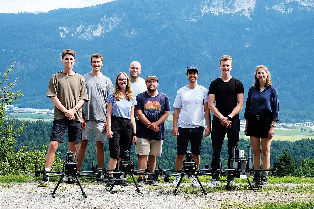
Kippenberger and other PhD students on the team were able within just a few weeks to gather so much data that they will be occupied for years on analysis and their doctoral theses. Weather services in Germany and other countries will be able to draw on the results of their research and train their weather models with them. ‘And, one day, far more precise weather forecasts in the mountains will be possible,’ says Andreas Platis, going on to risk a forecast of his own: ‘Maybe we’ll get there in five years.’

Andreas Platis from the Department of Applied Geosciences at the University of Tübingen.

Text: Tilman Wörtz


More articles

Hearing or Reading?

Which sense should we trust?

From Words to Deeds

Five alumni of the University of Tübingen share where their humanities degrees have taken them.